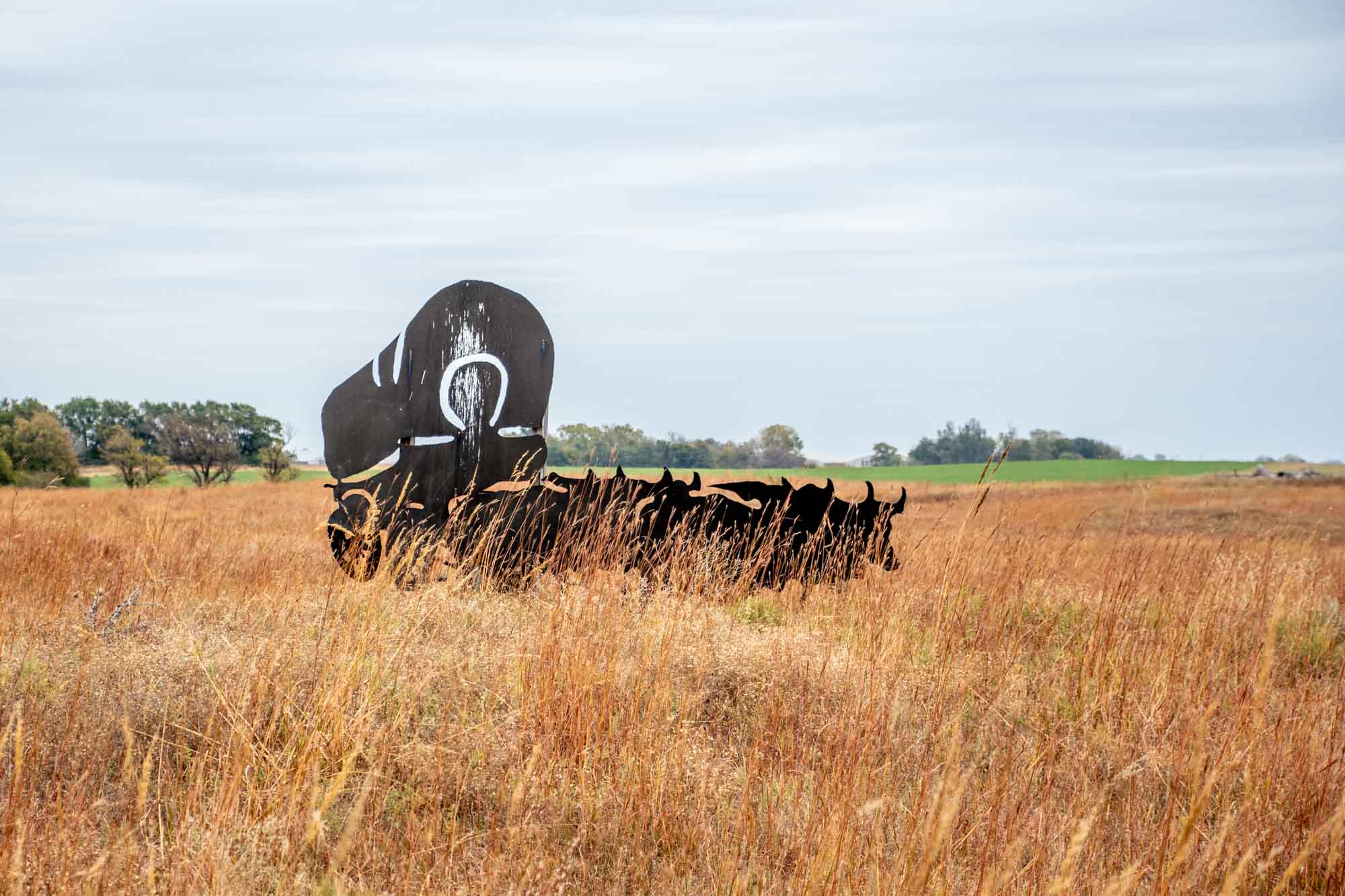
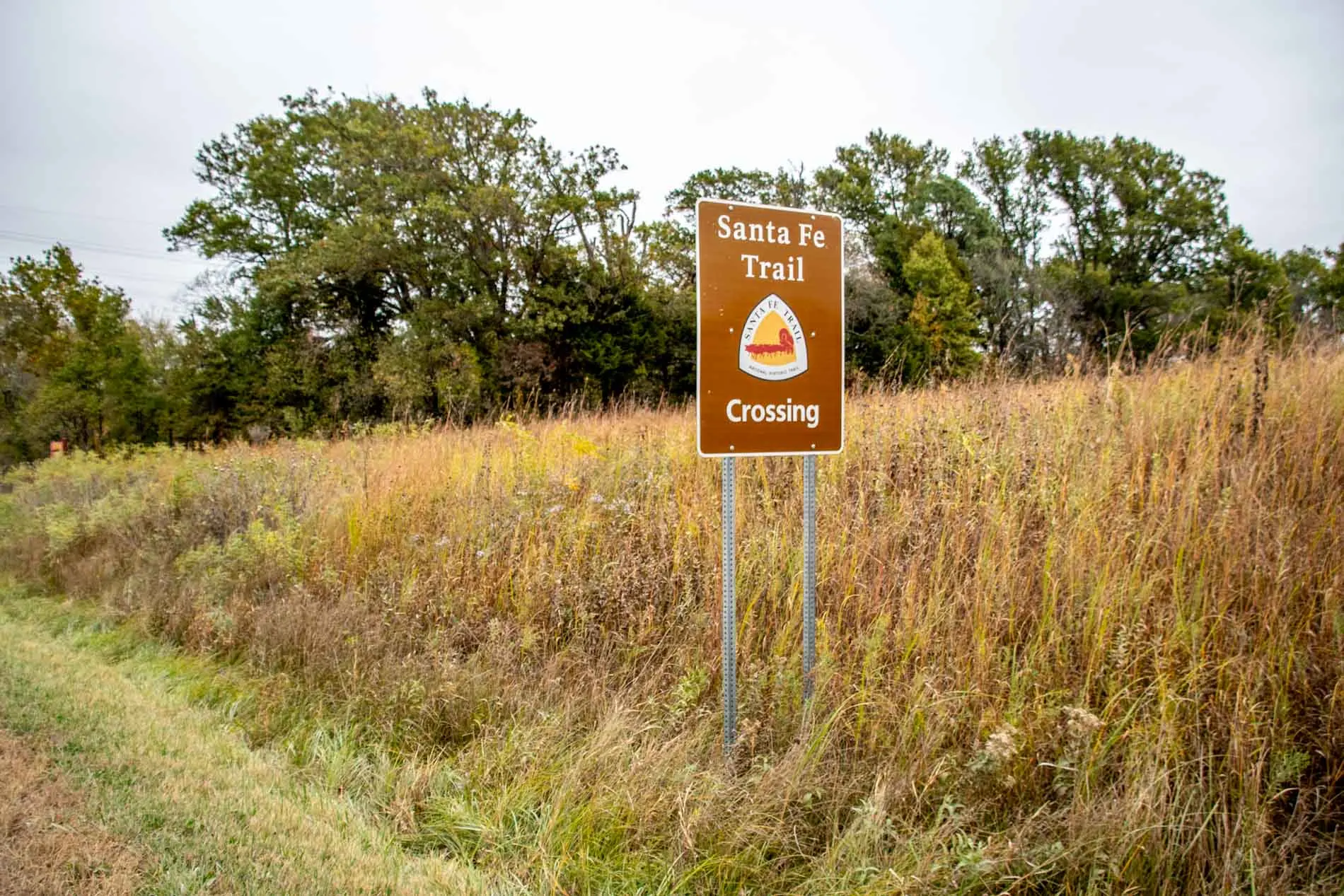
Across the Midwest, the land is still scarred by one of the most remarkable events of the 19th Century. For 50 years throughout the 1800s, the westward expansion of the United States occurred along the Santa Fe Trail. Today, travelers can relive that spirit of adventure by driving the Santa Fe Trail Auto Tour route.
As I was growing up in the American West, the Old Santa Fe Trail had a near ubiquitous quality to it. Local schools, restaurants and stores all the bore the name of this iconic trail from Missouri to Santa Fe, New Mexico. There was literally no escaping the route’s impact, and all of the businesses and roads served as daily reminder for me.
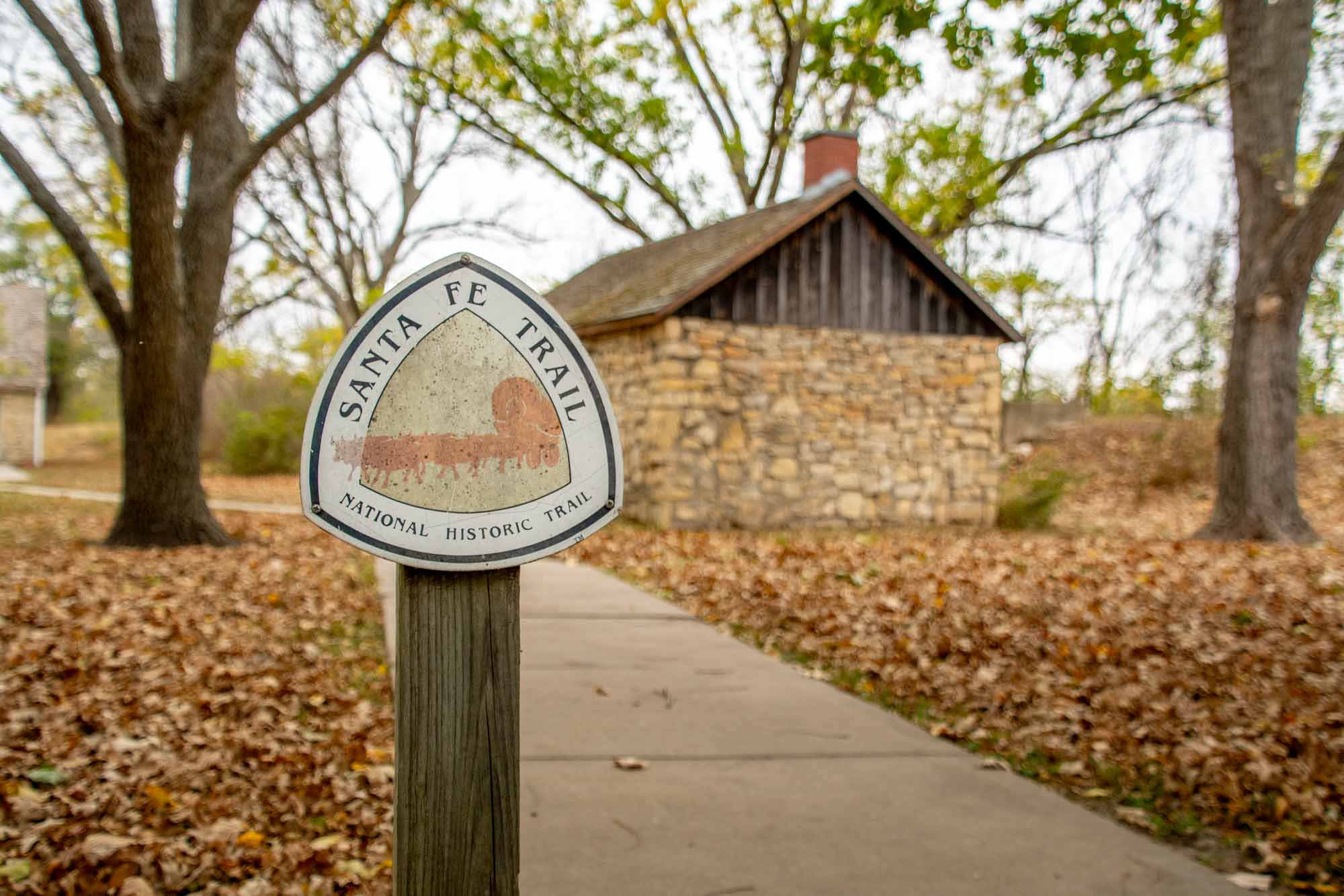

And yet, over 200 years later, the route still captures people’s interest. So one summer, we loaded up the car to drive the Santa Fe Trail and experience this national treasure first hand. This itinerary takes in the best sites along the Santa Fe Trail National Scenic Byway, a National Park Service designated byway.
History

The Old Santa Fe Trail was the main overland transport route for goods and people to the west. For 60 years, the trail was known for wealth and opportunity, but also for heartache.
For much of early period of American history, Santa Fe resided in the Spanish territories and was considered quite wealthy. As pioneers pushed west, developing trade with the Santa Fe was desirable. Unfortunately, the Spanish were quite hostile to the outsiders. All of that changed when the independent government of Mexico was established in 1821.

In the fall of 1821, a trader named William Becknell set out from Franklin, Missouri to establish a land trade route from the Midwest and points east to Santa Fe. Becknell’s trade goods proved popular in the new Mexican colony.
As word of his exploits spread, others got into the act. Within a few short years, numerous traders were making the overload route. For the first 25 years, until 1846, the road was used by Americans heading southwest, and by Mexicans heading northeast.
That changed in 1846 with the Mexcian-American War. Soon, the American military took control the trail and used it to push troops and weapons into Mexico. The Santa Fe Trail was extremely busy with military trade from 1846-1848. The strife ended with the Treaty of Guadalupe Hidalgo in 1848, but trade was just getting started.
From 1848-1866, the road boomed with westward expansion, settlers, gold prospectors and people looking to start a new life, which included a healthy number of immigrants from around Europe, but also the rest of the world. The Civil War years of 1861-1865 didn’t deter the westward expansion of the country.

Between 1866-1873, railroad lines were built all the way across Kansas, facilitating the movement of goods and people. And by February 1880, the railroad would cross Raton Pass and make it all the way to Santa Fe. With a rail option, the Santa Fe Trail ceased to be.
And yet, by the 1950s, there was a resurgence of interest in the trail from history buffs, school children and others. Soon, people began trying to recreate the journey – usually in cars, but sometimes on foot or on bicycles. The Santa Fe Trail would not die because the interest of America will always keep it alive.

There are a number of interesting sites along the Santa Fe Trail auto tour route that you can still visit today:
Old Franklin Town Site
The Old Franklin Town Site in Missouri holds great historical significance as it marks the beginning of the renowned Santa Fe Trail. Established in 1816, Franklin served as a vital trading and transportation hub in the early 19th century. The town was strategically located on the banks of the Missouri River, allowing for easy access to water transportation.
The Old Franklin Town Site now serves as a reminder of this historical era, although there’s not much to see. A flagpole in a field marks the site of the center of town. Near the road, there’s a couple of Santa Fe Trail markers to interpret the site.
A few miles south, in the town of Boonville, there are some interesting murals on the buildings that are worth noting. Old Franklin Town site is located about a mile and half northwest of Boonville on Missouri Route 87. (GPS coordinates: 38.987209, -92.755281)
Mahaffie Stagecoach Stop & Farm Historic Site
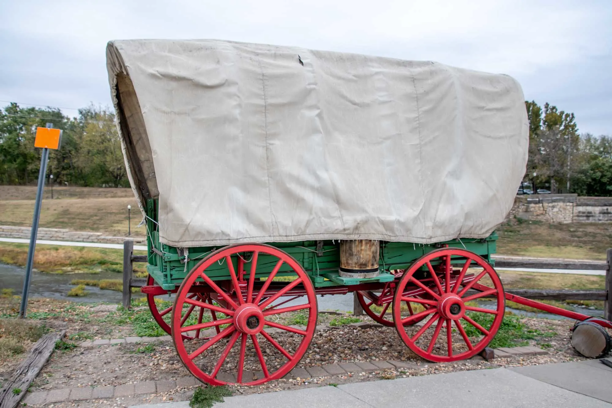
In the city of Olathe, Kansas, the Mahaffie Stagecoach Stop & Farm Historic Site has a unique distinction – it is the only surviving stagescoach stop still open to the public. Every summer, the Mahaffie Farmstead operates as a kind of living history farm that interprets the 1850s-1870s time period when James Beatty Mahaffie and his wife Lucinda operated the farm, stagecoach stop and inn.
The farm was uniquely positioned as the last major spot along all three of the major westward trails: The Santa Fe Trail, the Oregon Trail and the California Trial. At this point, mail and goods where shuffled depending on their ultimate destination. Located at 1200 E. Kansas City Road in Olathe.
Black Jack Ruts

On June 2, 1856, the Civil War effectively begin in Kansas with abolitionist John Brown leading an armed revolt. Despite occurring years before the start of the actual Civil War, this event was an important turning point in history.
The Black Jack Battlefield site is now a well preserved park with an log cabin that is open to school groups and during select periods. The battle took place during the period when the trail was operating and items inside the cabin structure are original to the period.
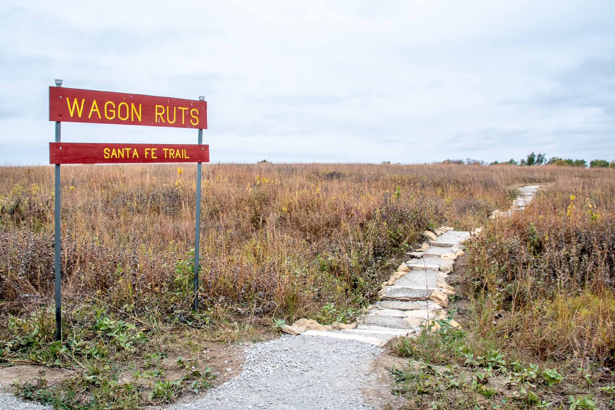
But Santa Fe Trail lovers focus their attention on the hillside about 400 yards before the battlefield. Here the Santa Fe Trail forged a small creek. Several dramatic, parallel trail ruts can still be seen on the hillside. During our drive across the Santa Fe Trail, the Black Jack Ruts were the best preserved and most impressive ruts we came across. There is a small footpath through the ruts which leaves from Black Jack Highway Park on U.S. 56. Located at 2011 N. 200 Rd. (GPS Coordinates: 38.766288, -95.129591)
Council Grove

Council Grove, Kansas holds significant importance on the Santa Fe Trail due to its role as a vital stopping point and supply center for travelers along the trail. Established in 1825, Council Grove served as a crucial rendezvous site for traders, pioneers, and Native American tribes.
The town’s location on the Neosho River provided a reliable water source for travelers and their livestock. Additionally, the area offered abundant timber for construction and fuel.
Council Grove gained its name from the council meetings held there between Native American tribes and government representatives. These councils played a crucial role in maintaining peace and fostering trade relationships between the settlers and Native Americans.
To resupply convoys, the town boasted several trading posts, blacksmith shops, and other essential services that catered to the needs of those traveling the Santa Fe Trail. It was the last supply point for over 600 miles.

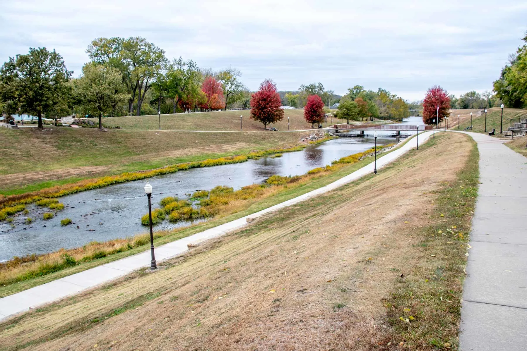
Today, Council Grove’s historical significance is preserved through numerous landmarks. Visitors can see the Council Oak, where meetings with the Native American tribes took place (located at the corner of E Main Street and N. 4th Street), as well as the Neosho River Crossing (where U.S. Highway 56/Main Street crosses the Neosho River).
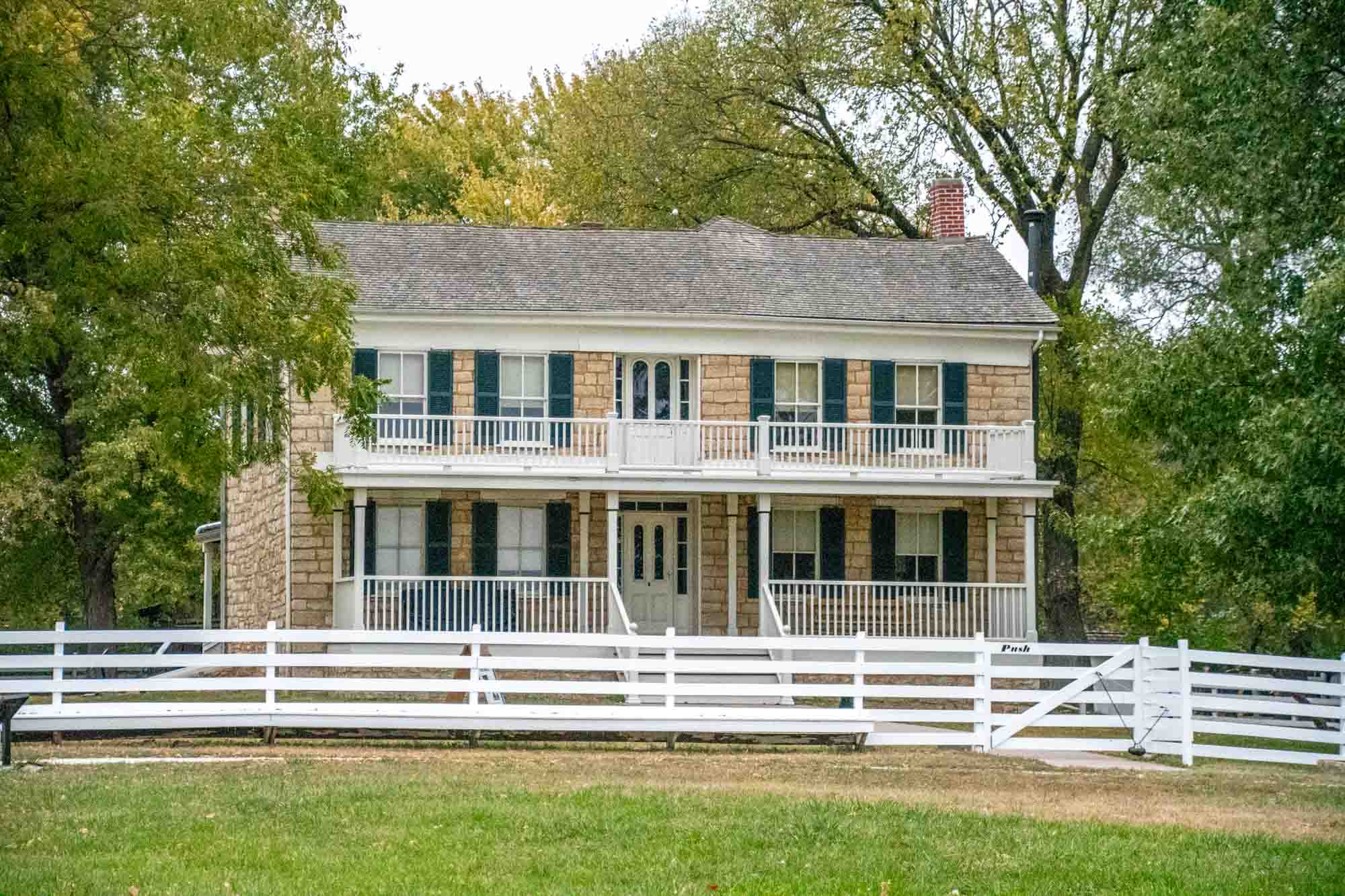
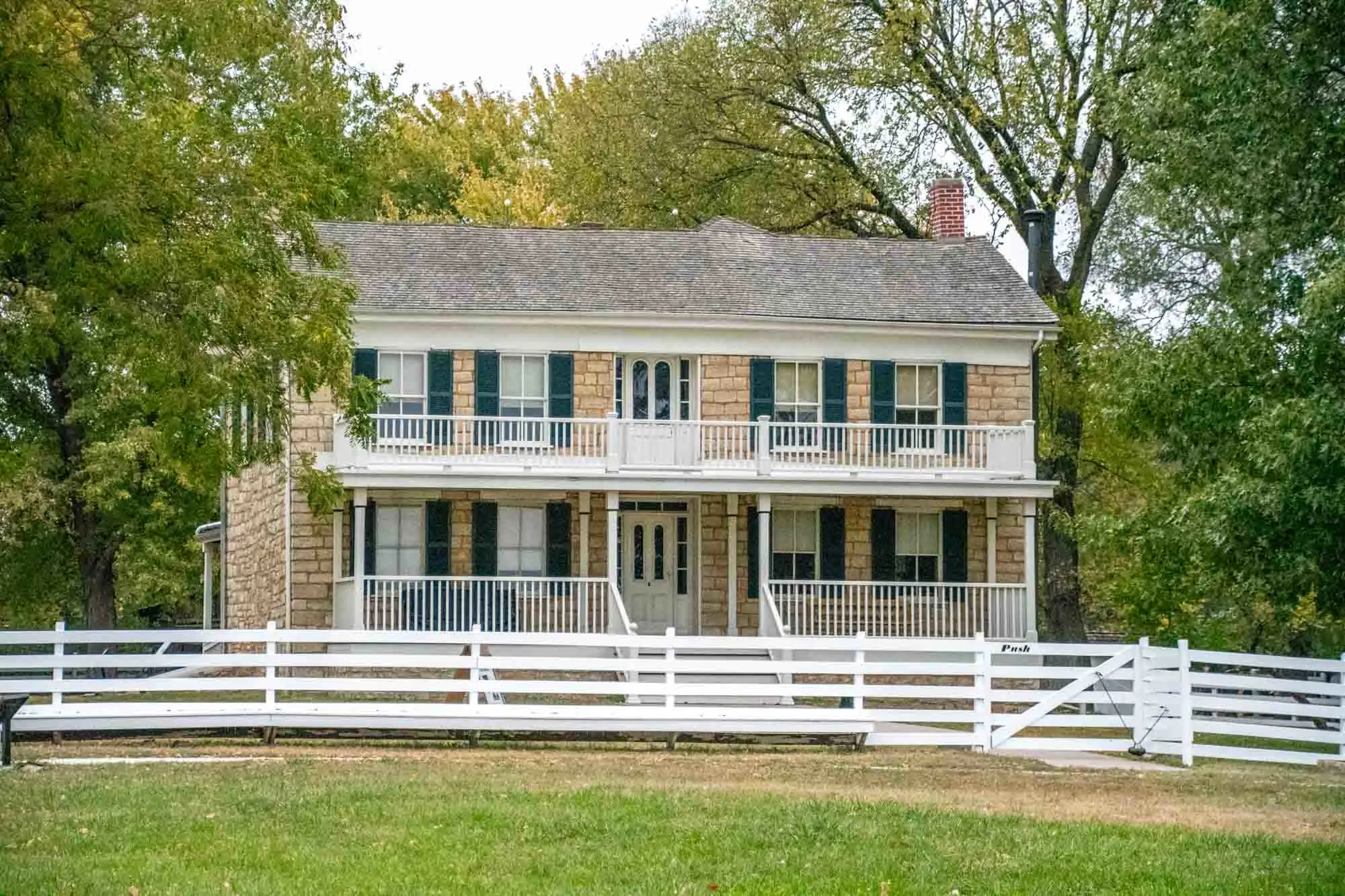
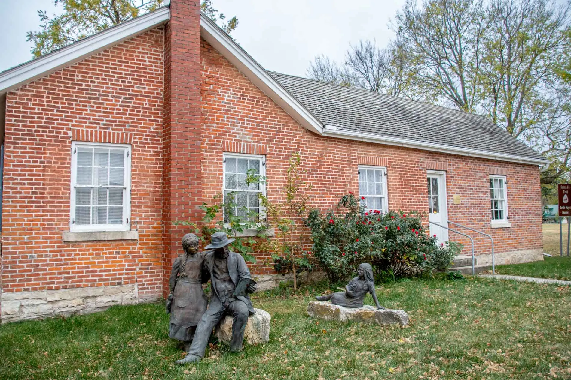
Finally, visitors can see the Seth Hays Home. Hays was the founder of the town (and grandson of Daniel Boone and cousin to Kit Carson). He arrived on the banks of the river in 1847 and stayed until his death in 1874. But his brick home is one of the few structures along the trail that has been preserved in its original condition. It’s now home to the local historical society. Located at 215 Wood St in Council Grove.
Tallgrass Prairie National Reserve
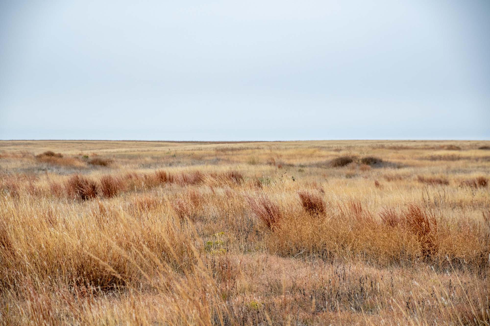
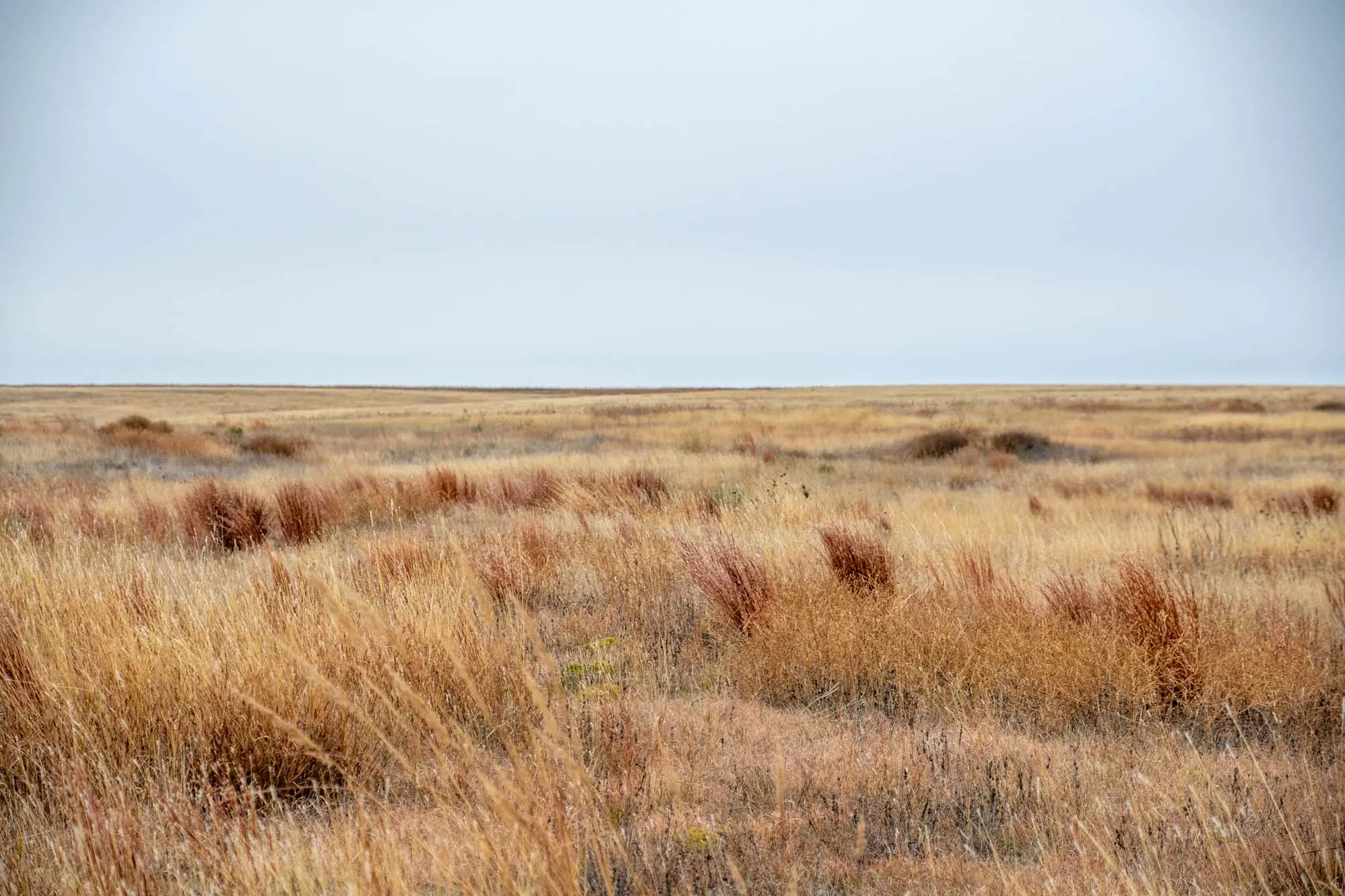
The Tallgrass Prairie National Reserve in Kansas is a breathtaking and ecologically significant destination that immerses visitors in the beauty and grandeur of the tallgrass prairie ecosystem. Stretching across thousands of acres, this protected area showcases the stunning natural landscapes that once dominated the heartland of America.
Most importantly, it is a chance to see what land around the Santa Fe Trail looked like before farming and cultivation. Put simply, visiting the Tallgrass Prairie National Reserve is the closest we can get to going back in time and seeing what the Santa Fe Trail was really like at the time.
If you are driving the Santa Fe Trail, consider making a stop here and talking a hike to experience the vastness and beauty of the American prairies. Located at 2480B KS-177 in Strong City, Kansas.
Ed Miller Grave
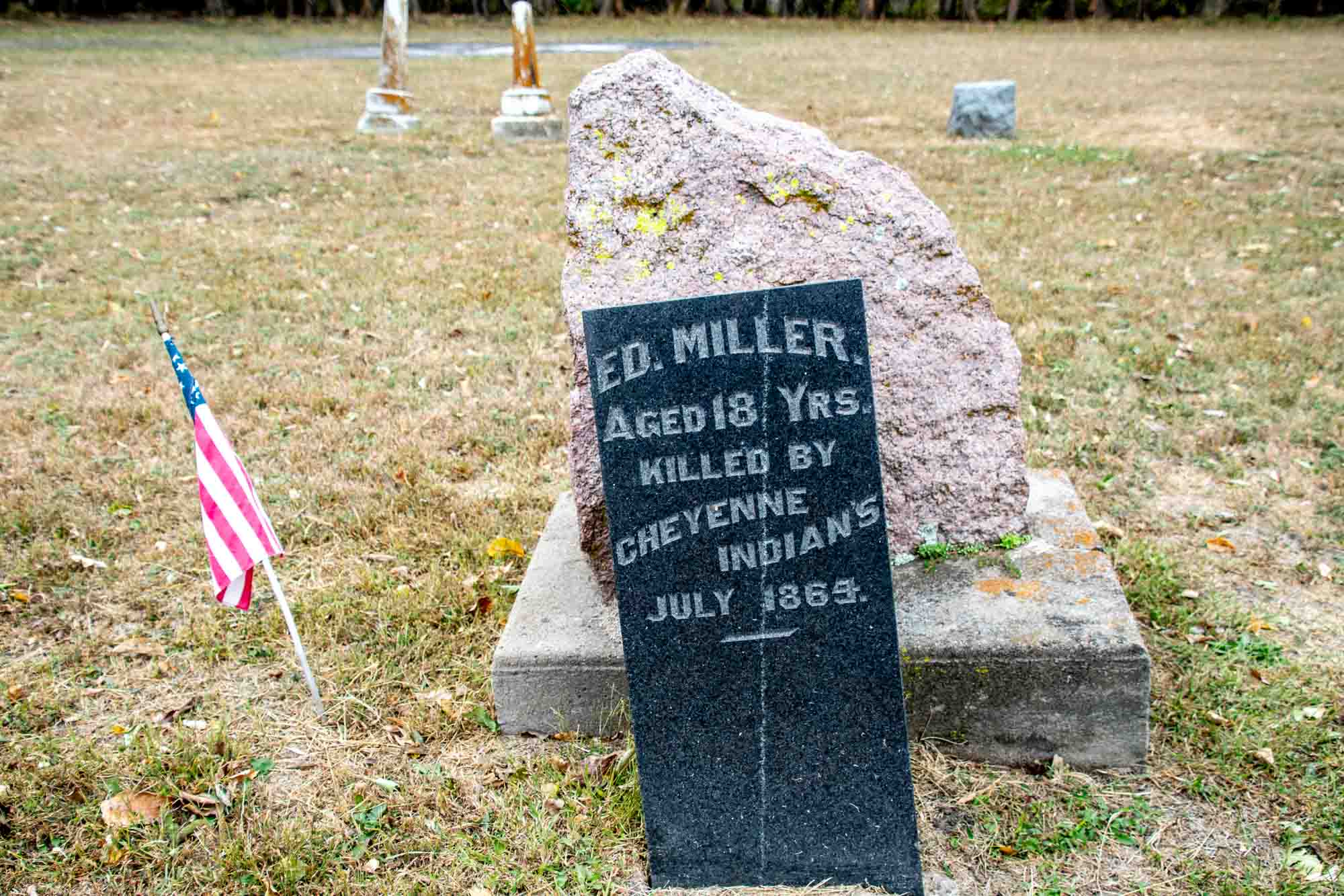
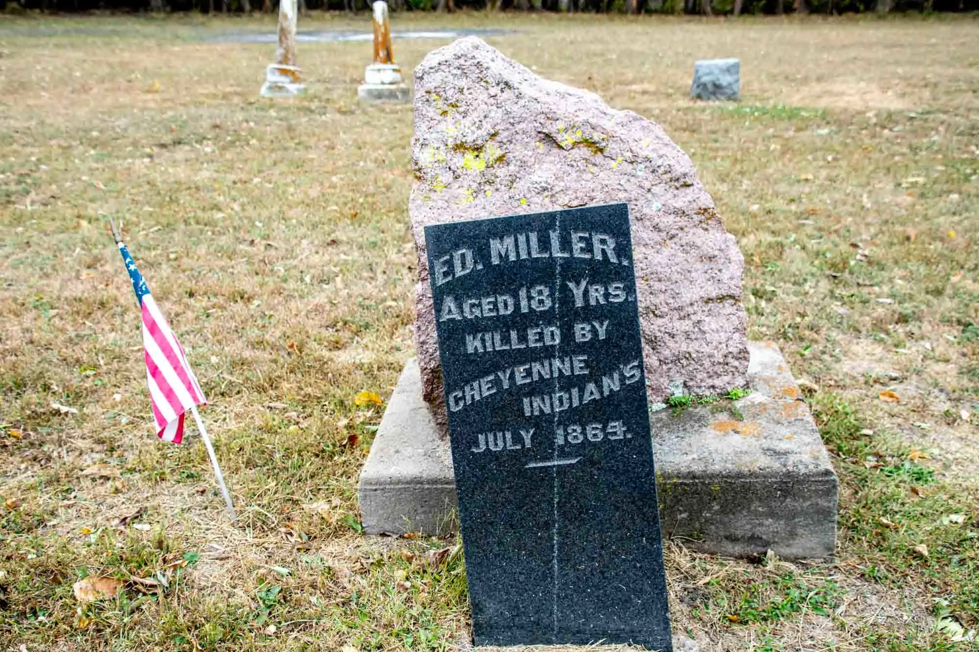
It is perhaps inevitable that the westward expansion of the country and the movement of goods and people along the trail would bring conflict. Armed conflicts between jittery white settlers and agitated American Indians were not unheard of.
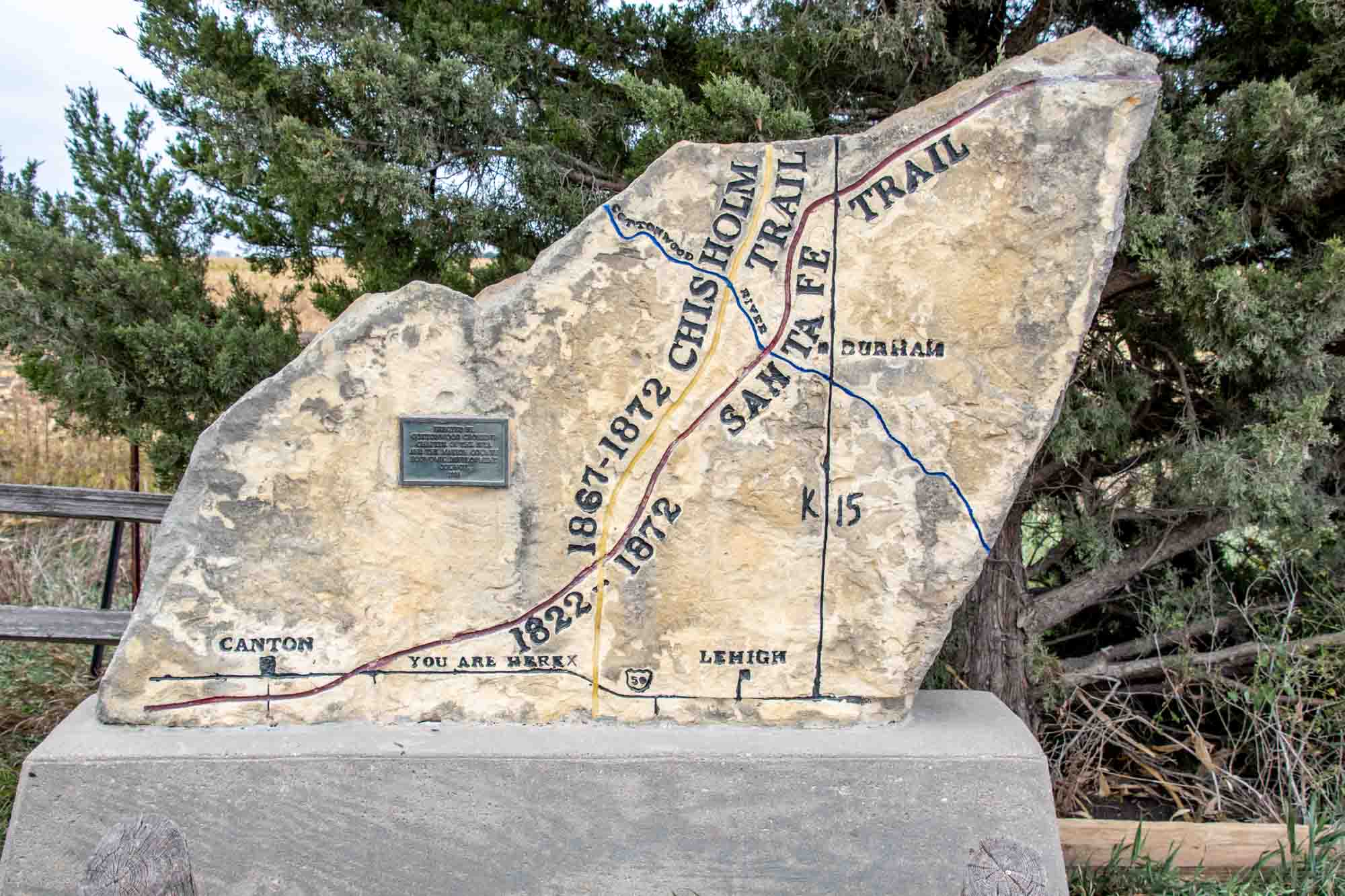
According to legend, in 1864, a young 18-year old named Ed Miller was working for the U.S. government as a dispatcher when he was attacked and killed by Cheyenne Indians. It is believed that Miller was the last white man killed by the Native Americans in western Kansas.
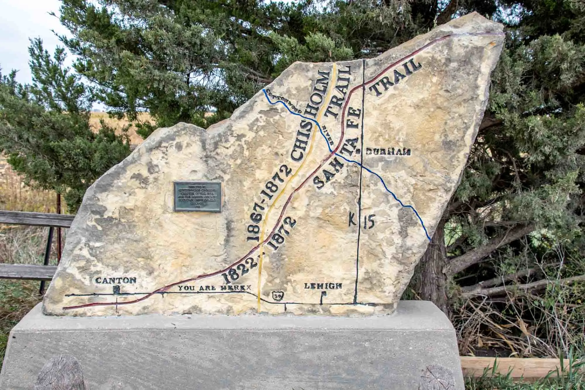
Visitors can read more about his story. Located on 29th Avenue, north of Route 56 in Canton, KS. (Approx. GPS coordinates: 38.383454, -97.386283).
Ralph’s Ruts
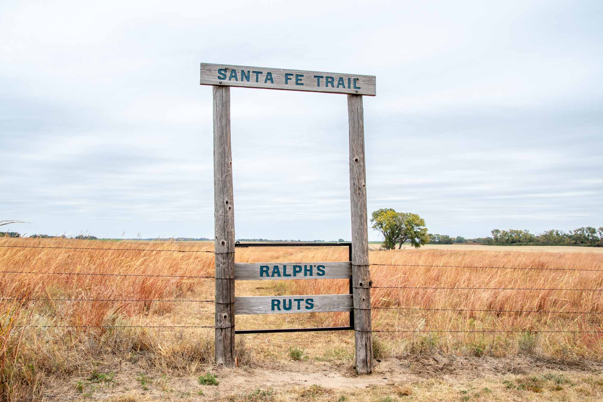

While there are many places in Kansas to see Santa Fe Trail Ruts, one of the most prominent and famous are the Ralph’s Ruts near the town of Chase, Kansas.
These ruts cross the land of Ralph Hathaway on land that was originally settled by his grandparents John and Mary Hathaway in 1878. Early on, it was recognized that the soil was too sandy to support crop cultivation, so it was left for grazing, which protected the trail ruts. Located on 4th Road about 4 miles west of Chase, Kansas and north of Highway 56.
Fort Zarah
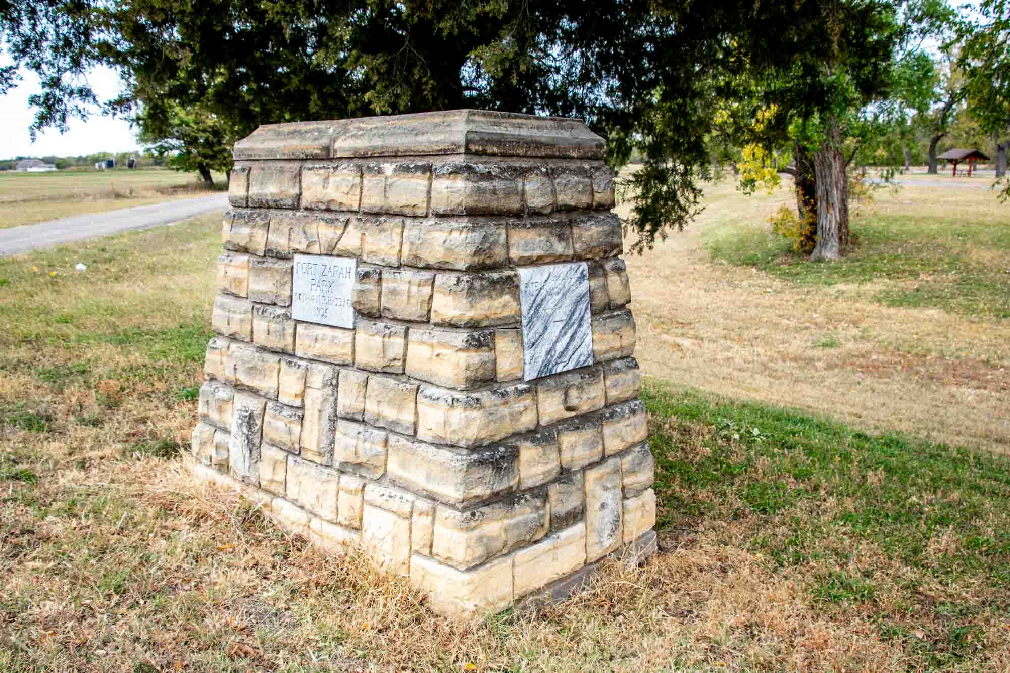

Situated along the route, the Santa Fe Trail brought travelers to the site of Fort Zarah, an impressive stronghold comprised of a substantial stone structure housing officers’ quarters, troop accommodations, mess halls, kitchens, and storage facilities. Functioning as a pivotal post during its active years, Fort Zarah served as a vital support system for those traversing the trail.
However, in 1869, a decision was made to abandon Fort Zarah due to a perceived decrease in the Indian threat. The government concluded that maintaining a second post in such close proximity to Fort Larned was unnecessary.
Today, remnants of this historic site can be found on the north side of US Highway 56, conveniently located just east of Great Bend. Fort Zarah State Park now occupies the area, offering a glimpse into the past and an opportunity to reflect upon the significance of this once-thriving military outpost. A historical marker of stones is the only thing to see. Located east of the town of Great Bend on the north side of Highway 56 just east of 30th Road along the banks of Walnut Creek. (GPS Coordinates: 38.365270, -98.713842)
Pawnee Rock
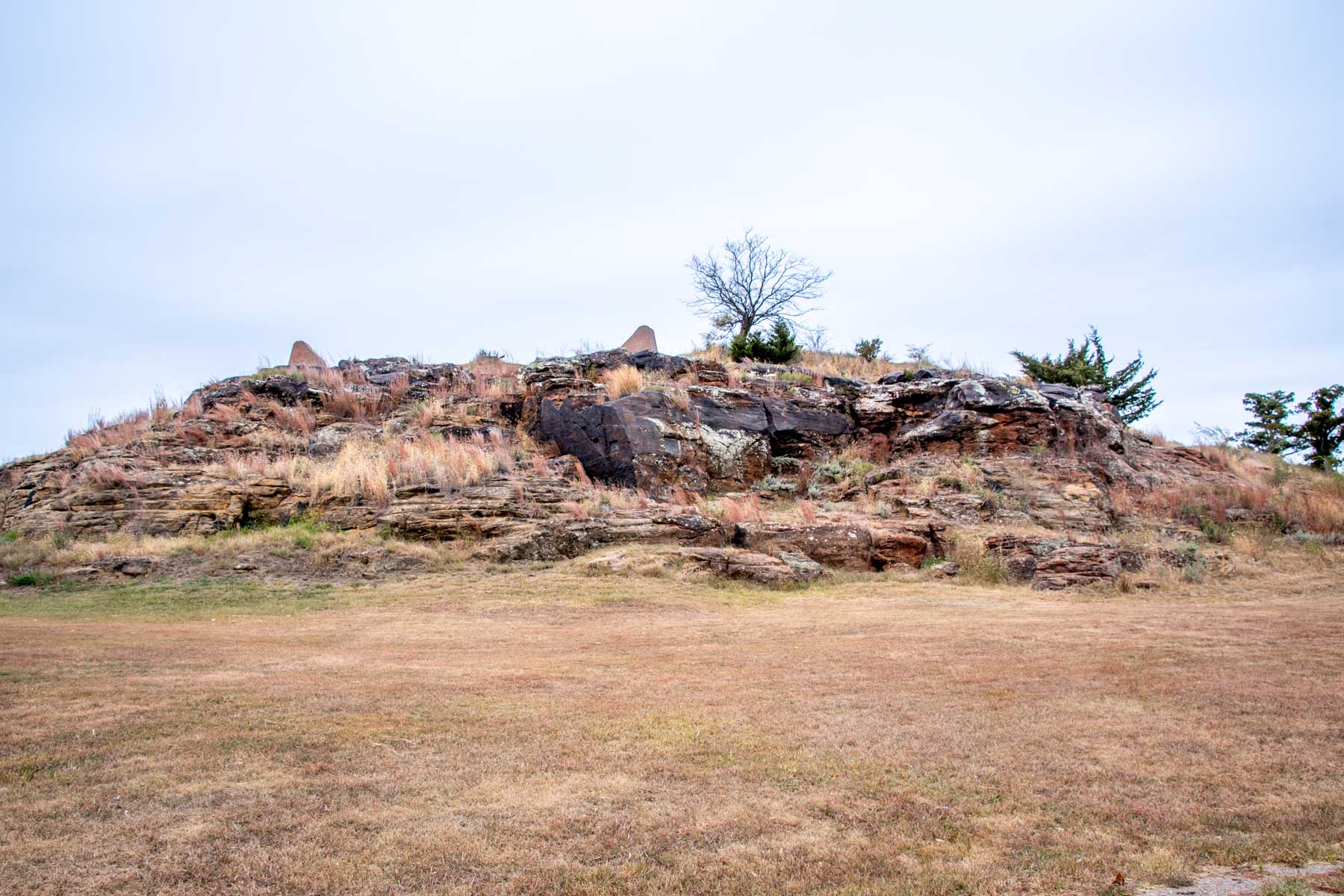

Continuing on its path, the Santa Fe Trail meandered alongside the majestic Arkansas River, eventually heading southwest near the present-day town of Great Bend, Kansas. From Great Bend, the next significant landmark travelers would encounter was referred to as “Pawnee Rock,” a notable natural formation on the trail.
Pawnee Rock gained prominence due to its distinctive presence—an imposing outcrop composed of Dakota sandstone. Legend has it that the rock derived its name from a battle between early settlers and the Pawnee Indians.
Pawnee Rock is a Kansas State Historic Site, preserving its historical and cultural significance. It’s well worth a visit to stand atop the rock and take in the sweeping panoramic views of the surrounding prairie from this elevated landmark. Located due north of the town of Pawnee Rock at 631 N. Center Street. It’s the tallest thing around, so you can’t miss it. (GPS Coordinates: 38.272051, -98.982022)
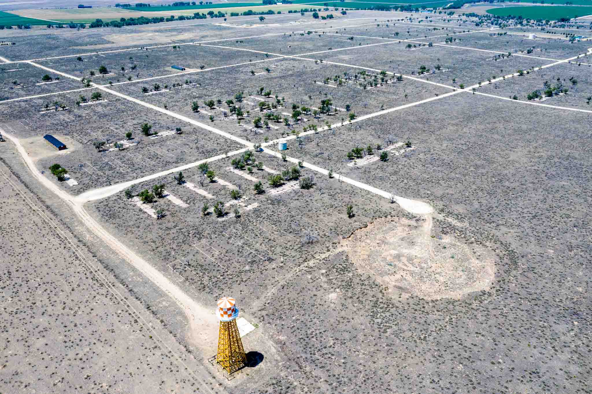
Fort Dodge, Kansas
Fort Dodge played an important part in the growth of the Santa Fe Trail. One of the most important military outposts along the trail, Fort Atkinson, was located a few miles outside the town. Later, Fort Dodge took over the role of protecting travelers.
From 1865-1882, the military outpost of Fort Dodge protected by travelers along the Santa Fe Trail as well as traders, trappers and hunters. It was the first and largest community in Western Kansas. When the military fort was decommissioned, it was turned over to the state to become the Kansas Soldiers’ Home. Located at 714 Sheridan in Fort Dodge, KS.
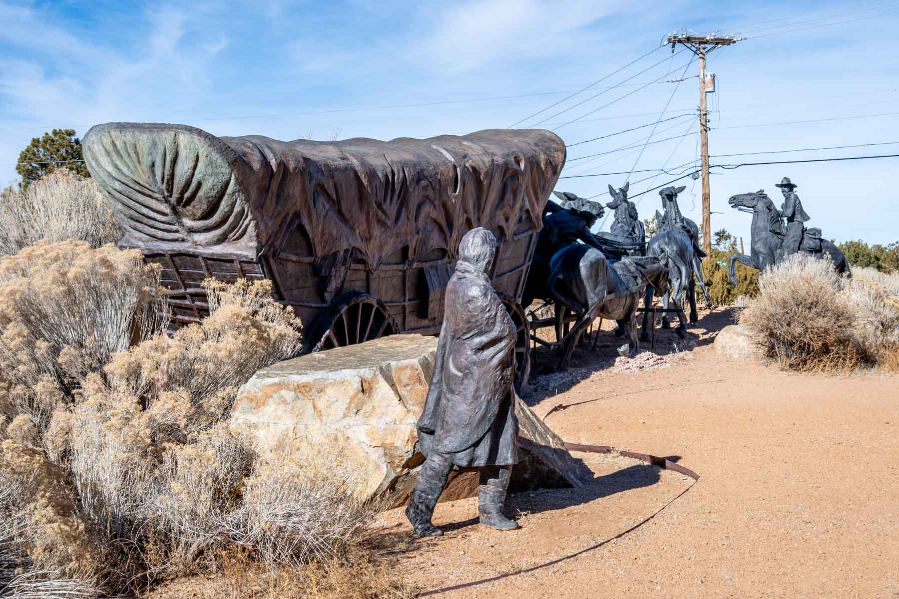
Caches Monument

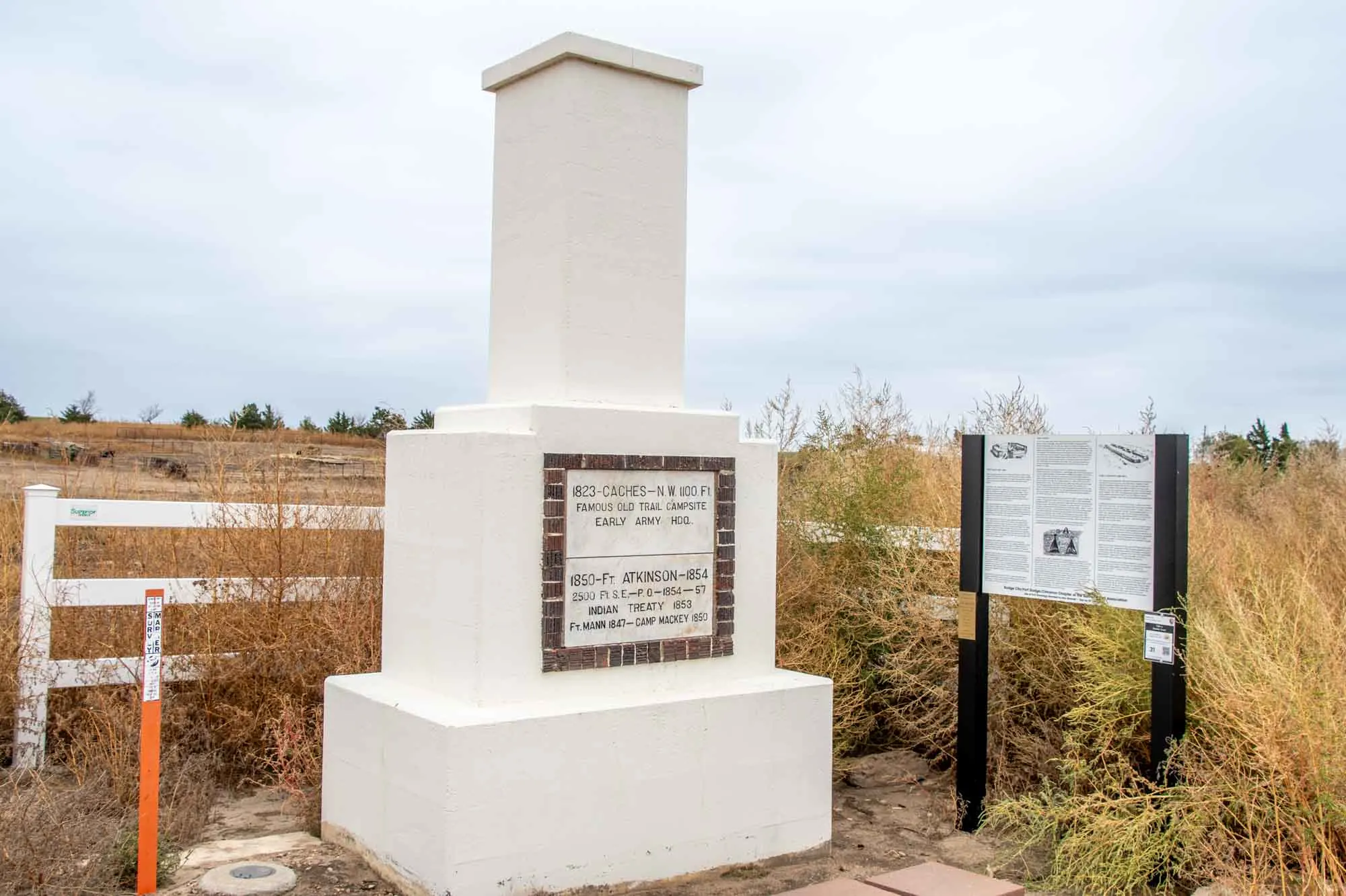
Gracing the landscape along US-50 west of Dodge City, a striking marble column stands as a testament to the historical significance of the Mountain Route of the Santa Fe Trail. Nestled north of the highway, this monument serves as a commemoration of several key milestones in the trail’s rich history.
First and foremost, the column honors the notable Caches campsite of 1823, a crucial waypoint along the Santa Fe Trail that facilitated trade and exploration. Additionally, it pays homage to Fort Atkinson and Fort Mann, two formidable military outposts that safeguarded the trail from 1850 to 1857, ensuring safe passage for travelers and protecting vital supply lines. Located at US-50 and 107th Road. (GPS Coordinates: 37.758643, -100.087858)
Santa Fe Trail Tracks

For over 60 years, horses and wagons wore deep groves in this land just north of the Arkansas River. These Santa Fe Trail tracks are all that remain.
From the parking lot, walk uphill about 100 yards for a good view of the overlook. Then proceed walking north across a series of small bridges. As you look to your left and right, you will see the trail ruts in the land. While the area is heavily overgrown with vegetation in the summers, these tracks tell the story of time. Located along US-50 about 11 miles west of Dodge City, Kansas. (GPS Coordinates: 37.789486, -100.197578)
Bent’s Old Fort
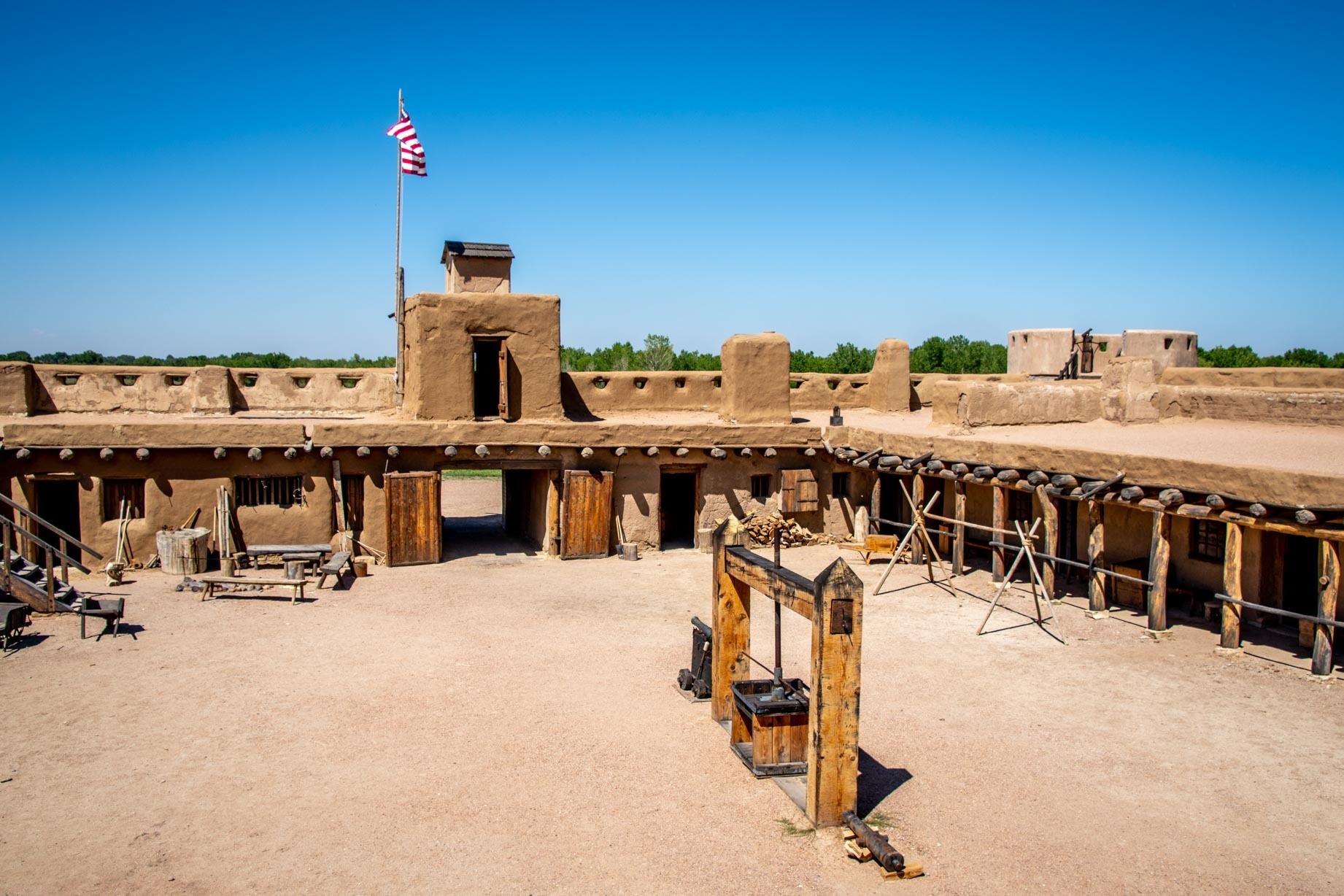

The Mountain Route of the Santa Fe Trail headed northwest into Colorado following the banks of the Arkansas River. It was here that the Bent brothers, William and Charles, hailing from a prominent St. Louis family, stumbled upon an opportunity in the West. They brothers led a caravan train to Santa Fe in 1829, marking a successful endeavor. Along the way, the noticed that was nowhere to re-provision between Council Grove, Kansas and Santa Fe, New Mexico – a distance of hundreds of miles.
Sensing opportunity, they sought to build a settlement. In 1833, they established Fort William (now known as Bent’s Fort) on the northern bank of the Arkansas River. The fort, situated on the boundary between the United States and Mexico, served as a crucial resupply point while also facilitating trade with the local Native American tribes, including the Kiowa, Arapaho, Cheyenne, and Comanche.
In 1846, Bent’s Fort took on military significance when it became a key organizational and deployment site for the “Army of the West” led by Colonel Stephen Watts Kearny during the Mexican-American War.
After the death of his broth Charles in 1847 and the description of the old fort, William constructed a new fortification known as Bent’s New Fort, located 40 miles downstream at a place called Big Timbers, where Native American tribes traditionally wintered. By 1853, the new fort was fully operational. Subsequently, in 1859, William sold the new fort to the U.S. government, which renamed it Fort Wise.
Bent’s Old Fort (which has been entirely reconstructed) is a highlight for visitors driving the Santa Fe Trail byway. Read our detailed article about visiting Bent’s Old Fort. Located at 35110 CO-194, La Junta, Colorado. (GPS Coordinates: 38.043824, -103.431786)

Note: Bent’s Old Fort is very close to the Camp Amache Relocation and Detention Center, one of the centers for Japanese-Americans during World War II. We highly recommend visiting this important site, which is located along the Santa Fe Trail (although it is obviously much more recent).
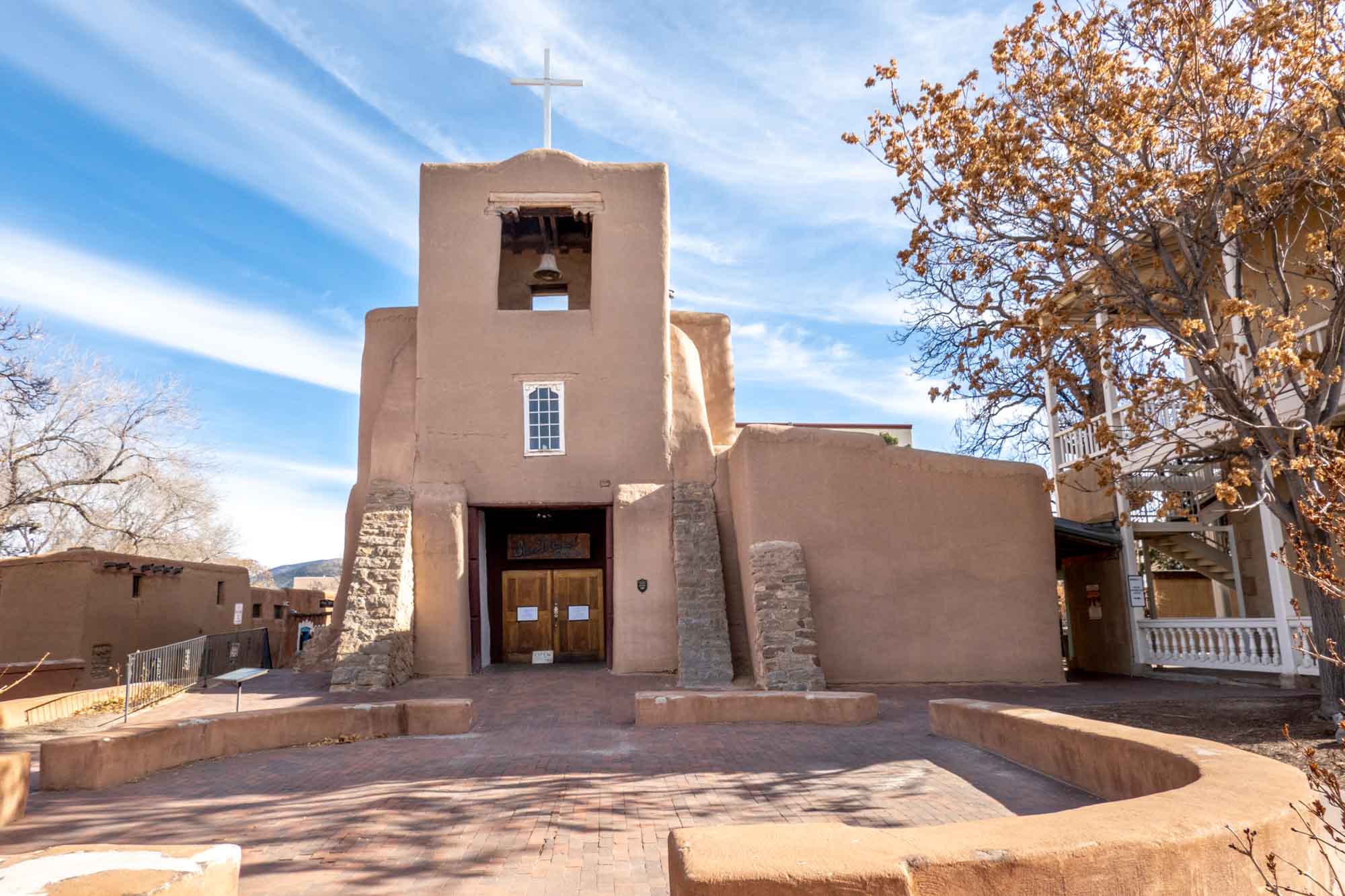
Santa Fe

The goal of travelers was Santa Fe, New Mexico. Originally established in 1610 and is one of the oldest cities in United States, this town had over 15,000 inhabitants in 1820 and was a major center of commerce.
When Mexico secured its Independence from Spain in 1821 (and voided Spain’s policy of economic isolationism), the westward rush began. Over the next 60 years, thousands made the trek along the 800+ mile Santa Fe Trail to reach this city.
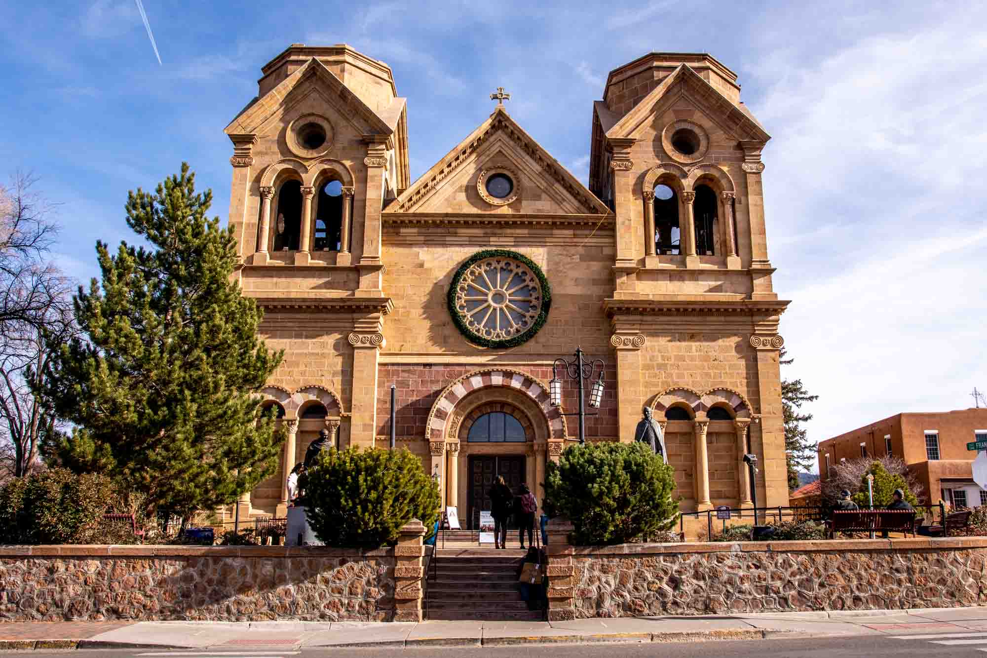

People visiting Santa Fe can still see many trail-era sites. The Santa Fe Plaza still exists, as does the Mission, the Palace of the Governors, and the historic San Miguel Mission Church (the oldest church in the continental United States dating back to 1610).
Itinerary

If you are considering driving the Santa Fe Trail Auto Route, we recommend breaking up the trip into four days. While it is technically possible to drive the trail straight through in about 17 hours (no stops), you’ll want to get out of the car and visit some of these sites. Consider breakup up the route as follows:
- Boonville, Missouri to Kansas City/Olathe, Kansas
- Kansas City/Olathe, KS to Dodge City, KS
- Dodge City, KS to Las Vegas, NM
- Las Vegas, NM to Santa Fe, NM
This will give you time to explore and see some of the sights.
A final thought on driving the auto trail. Actual driving times are far longer than the distances and speed limits would indicate. You’ll hit railroad crossings and farm vehicles out on the roadways, which will slow you down. Enjoy life in the slow lane and savor the journey for what it is.
Have you done the Santa Fe Trail driving route? What did you find were the highlights?
Lance Longwell is a travel writer and photographer who has published Travel Addicts since 2008, making it one of the oldest travel blogs. He is a life-long traveler, having visited all 50 of the United States by the time he graduated high school. Lance has continued his adventures by visiting 70 countries on 5 continents – all in search of the world’s perfect sausage. He’s a passionate foodie and enjoys hot springs and cultural oddities. When he’s not traveling (or writing about travel), you’ll find him photographing his hometown of Philadelphia.
Bob Trailman
Monday 20th of November 2023
No, but it going on the bucket list. Was going to do a route 50 trip but just might divert off and do some route 56 and see what happens.