When it comes to natural beauty, there’s no state in America more beautiful than Utah. The Beehive State is blessed with beautiful mountains, stunning deserts and otherworldly rock formations. And nowhere is that beauty more pronounced than in the five Utah national parks located in the southern part of the state.
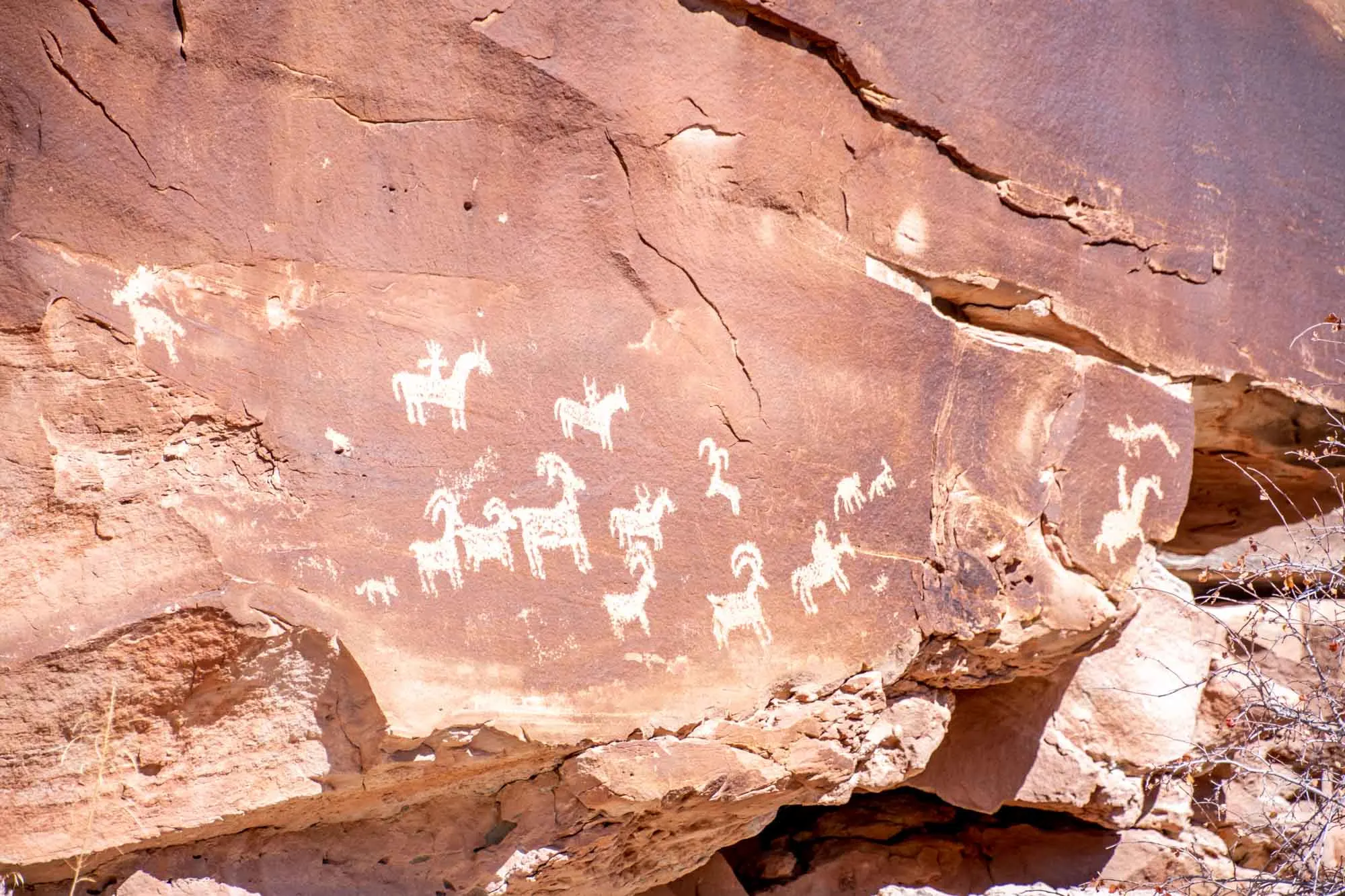
Growing up in neighboring Colorado, I had numerous opportunities to explore and fall in love with Utah and its red rock landscape. I would take off from school and wander remote trails in the footsteps of Edward Abbey (a notable author and former park ranger at Arches).
The beauty found in Utah is iconic. The sandstone arches found throughout state are what most people around the world think of when they conjure an image of America’s national parks. The state even put the arch on its official license plate.

Utah has the third largest number of national parks in the United States (behind California and Alaska). The Utah parks are Zion, Bryce Canyon, Capitol Reef, Canyonlands, and Arches (listed in order from south to north). Several years ago, Visit Utah dubbed these national parks in Utah as The Mighty 5.
Most visitors arrive via the major airports in either Las Vegas, Nevada or Salt Lake City. We’ve organized this guide as if you are coming from Las Vegas (but you can easily flip the order). You’ll find a suggested itinerary at the end of the article.
Having visited each of Utah’s national parks at least a half-dozen times in both summer and winter, here are my recommendations:
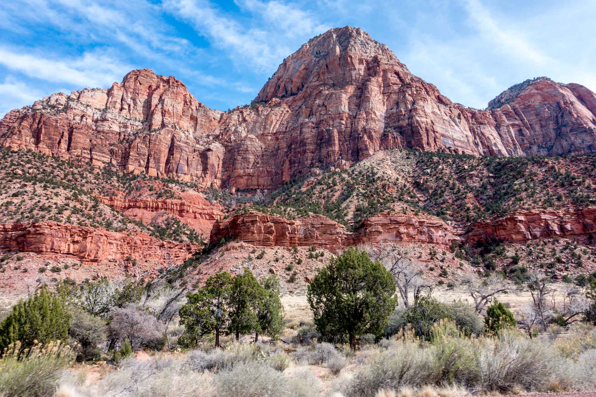
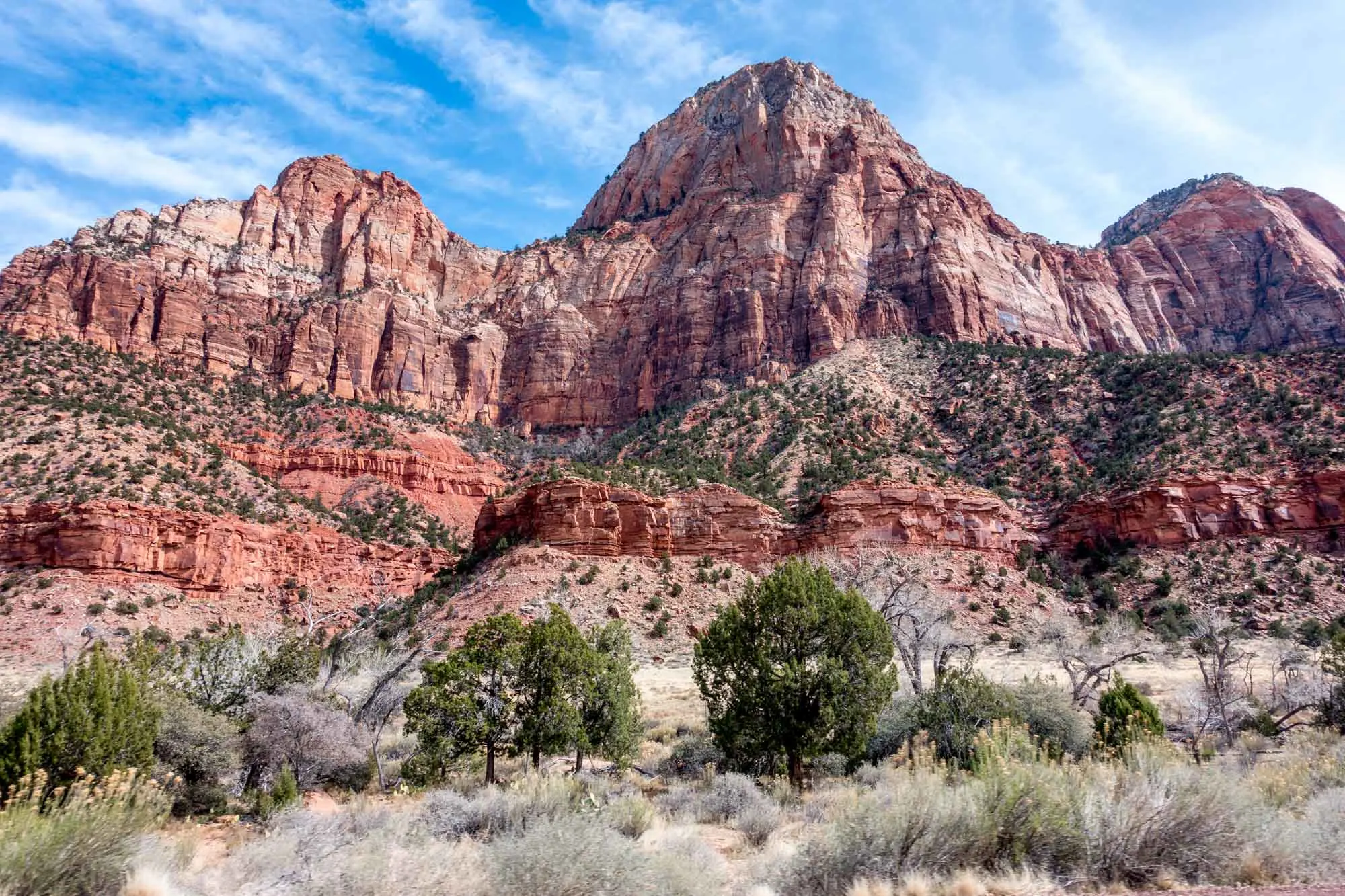
Zion National Park

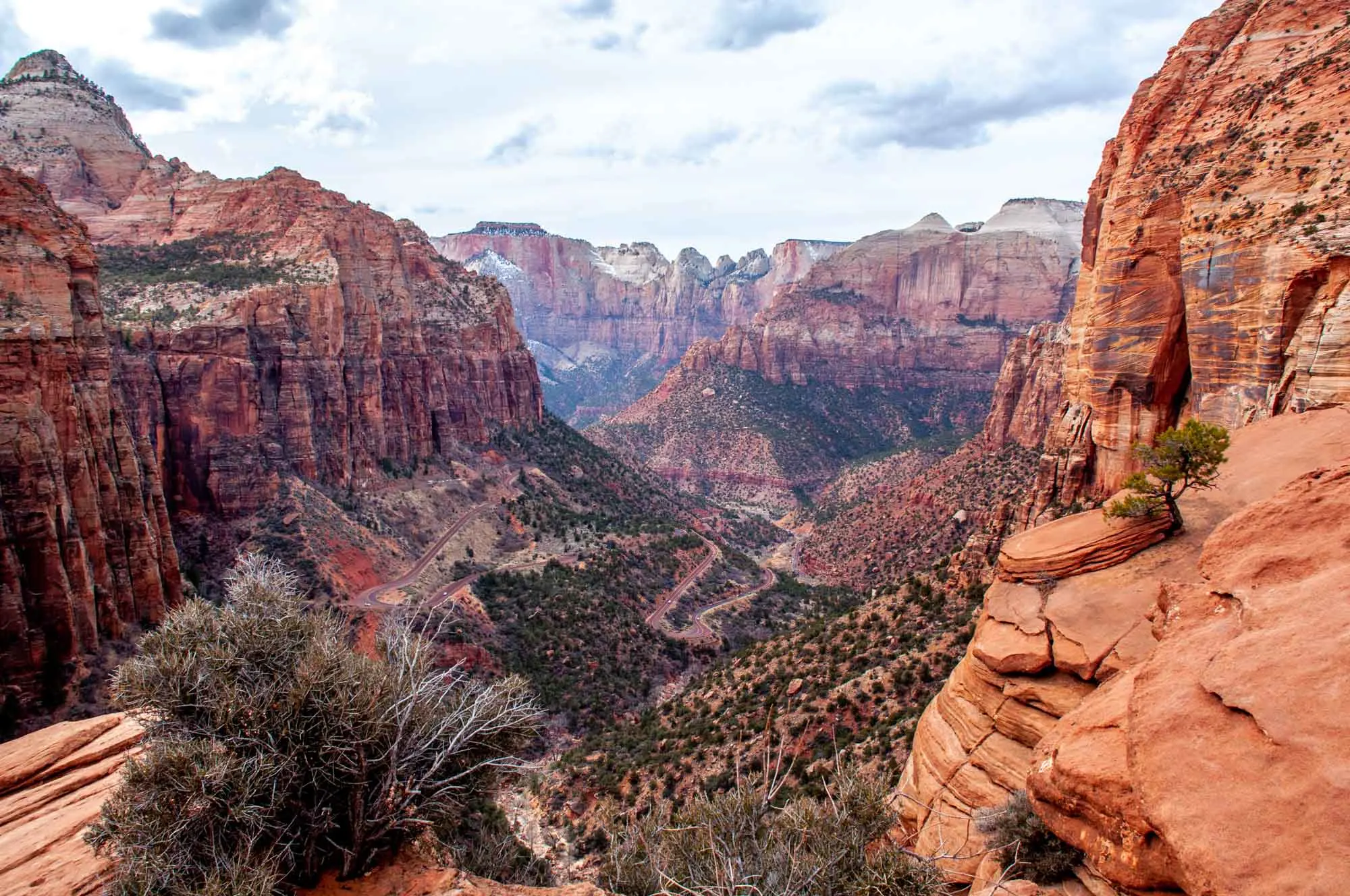
A paradise for hikers, Zion is spread across a series of deep canyons. Originally the home to Virgin Anasazi and then used by Spanish trappers, Zion has been a crown jewel in the national park system since 1919. It is also the third most visited national park in America.
Highlights: The highlight at Zion is the 1000-foot deep canyon along the Virgin River. The stunning red rock canyon is one of the most beautiful in the west. Hiking trails originate from the floor of the canyon and along the rims.
The top hikes are the famed Angels Landing. This strenuous 5.4-mile hike climbs over 1500 feet and offers stunning views of the canyon. It also offers extreme drop-offs and is not suitable for those with a fear of heights. A special Angels Landing hiking permit is required for for the hike. The permits are offered in a next-day drawing or in a special, 4-time per year lottery. The penalties for attempting the hike without the permit are severe.
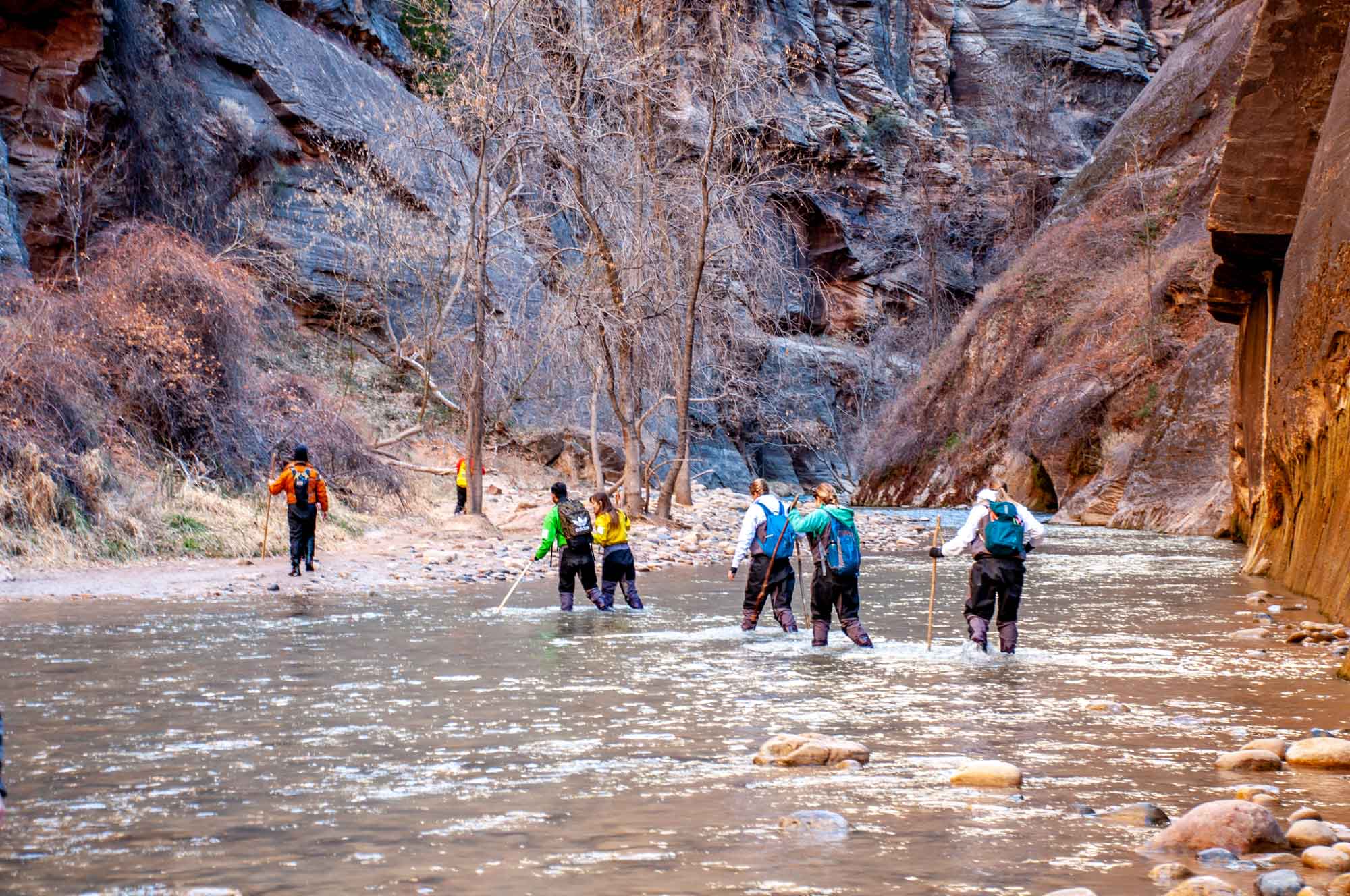
Also popular is a strenuous 9.4-mile hike up the Virgin River called The Narrows. This hike is in the cold water and can be quite challenging. For those looking for easier hikes, the easier Riverside Walk (handicap accessible) and the Emerald Pool hikes are much shorter and easier.
One of our favorites is the Canyon Overlook Trail that looks down on Zion Canyon. This short 1-mile trail offers Angels Landing-like views, without the extreme hike and drop offs. This trail leaves from the tiny parking lot above the tunnel.
Getting there: Zion National Park is 3 hours from Las Vegas and 4 ¼ hours from Salt Lake City. Most Zion visitors use Springdale, Utah as a base to stay and explore (about 5 minutes from the park entrance). However, another option is to visit from the east side using Kanab, Utah as a base (about 30 miles/35 minutes away). Kanab is further from Zion, but puts you closer other attractions like Bryce Canyon, the Grand Canyon, The Wave, The White Pocket and Vermilion Cliffs, and Lake Powell/Horseshoe Bend.
For much of the year, private vehicles are prohibited in Zion Canyon. The National Park Service uses a shuttle system that is similar to other parks like the Grand Canyon. Private cars can go to the visitor center and then pass through the park to the east along the Mount Carmel Highway (Utah State Route 9).
Tips: Arrive early in the day or late in the afternoon. Expect long lines for shuttle buses during peak season. The weekends as well as Mondays and Fridays can be especially busy. Try to time your visit mid-week for fewer people. If trying to secure a Angels Landing permit, have a back-up plan in place in case you are unsuccessful.
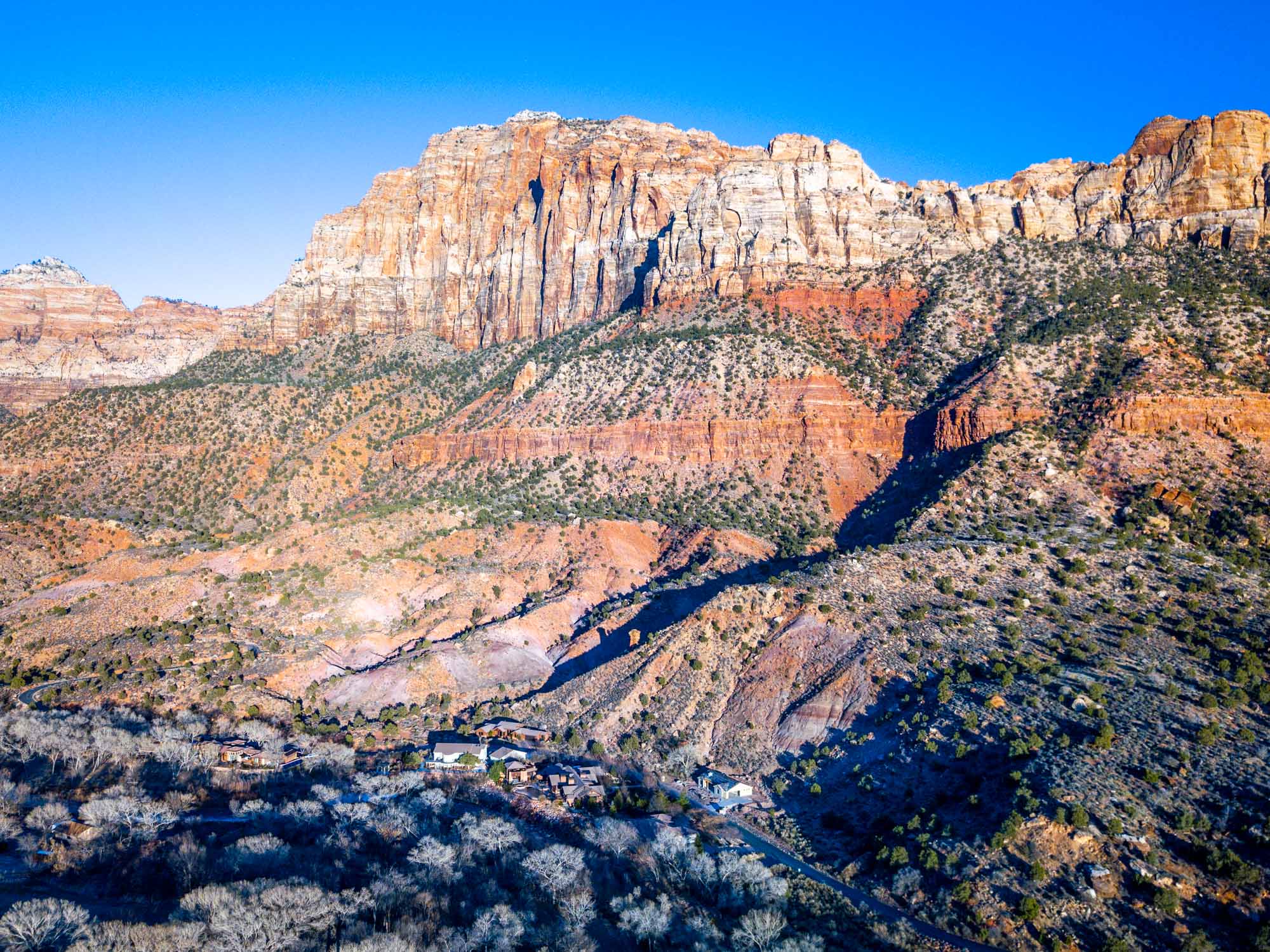
Stay/Eat: If staying in Springdale, there are a number of hotels and small vacation rentals available. We prefer to stay at the south end of town, which is further from the park, but has less traffic congestion. Our preferred hotel is the Springhill Suites, which is modern, clean and comfortable. They also have a great pool and hot tub, which is perfect after a long day of hiking. You can sit in the hot tub and look out at The Watchman rock formation located just inside the park.
A solid back-up choice is the Hampton Inn, also located south of town. For dining, consider the Switchback Grille, which has a lot of options in an unpretentious environment.
If staying in Kanab, consider either the Quality Inn or the Hampton Inn, both located right in town. For dining, the Peekaboo Canyon Wood Fired Kitchen serves fantastic pizzas (and just happens to be all vegetarian). Trust us, the pizzas are divine!
Bryce Canyon National Park

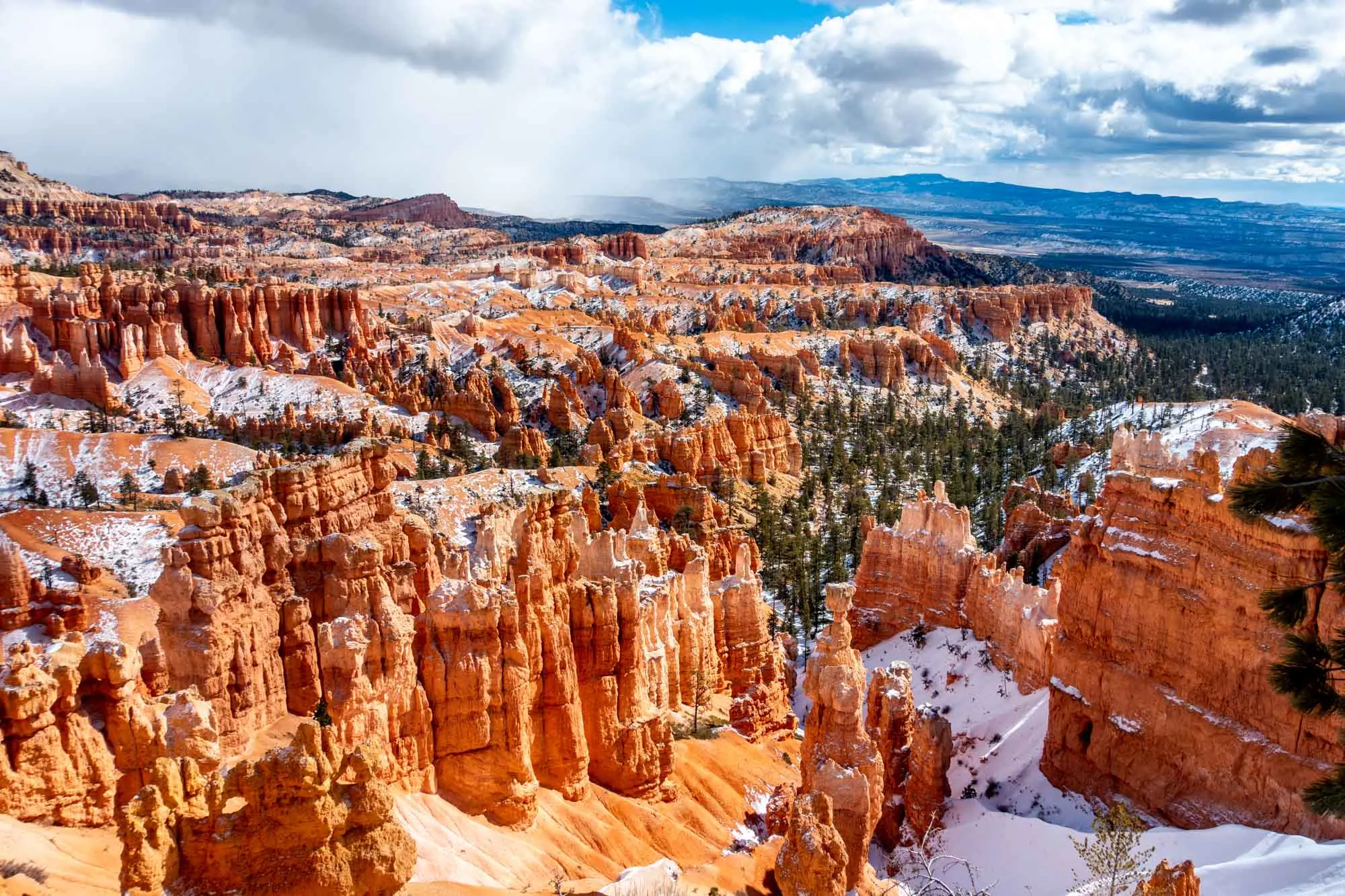
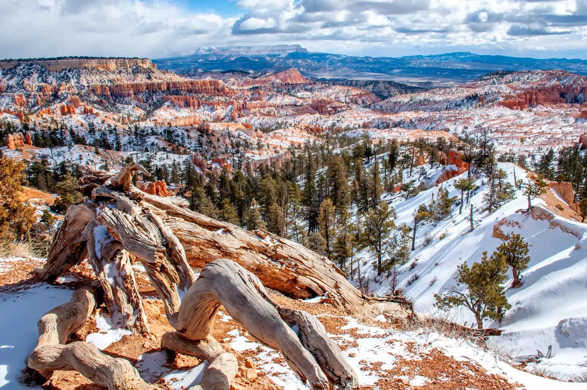
One of the most iconic images from the state of Utah, Bryce Canyon is instantly recognizable. The defining feature of the park is the massive amphitheater filled with hoodoo spires. Originally home to the Anasazi and the Paiute, it later be a national monument and was then upgraded to a national park in 1928.
Highlights: The crown jewel of Bryce Canyon is the massive amphitheater, which stretches over 12 miles in length and nearly 3-miles across. It was caused by headward erosion across a broad area. As the land eroded, the iconic hoodoos were left by inconsistent erosion speeds.
There are 13 viewpoints of the amphitheaters. It is generally recommended to start early the morning and visit Sunrise Point, then head all the way to Rainbow Point and work your way back to Sunset Point. In the afternoon, when you are back by the main amphitheater, consider doing a hike.
The two most famous hikes are the Queen’s Garden, a 1.8 mile down and back trail down among the hoodoos. The other is the Navajo Loop, a 1.3-mile STEEP loop with incredible hoodoo views.

Getting there: Bryce is located 70 miles/85 minutes northeast of Zion NP. It is the highest national park in Utah with the rim at nearly 9,000 feet. It is also located north of the Grand Staircase-Escalante National Monument, making it feel much more remote. There is a small village of Bryce just outside of the park, but no real town to speak of (limited services).
Within Bryce Canyon NP, there is a shuttle bus, however, usage of the shuttle is not mandatory. During peak season, the shuttle might be a smart move. But during the non-peak periods, there is ample parking within the park. Given the park elevation, some parts of Bryce are closed during the winter.
Tips: There’s not much to do in the town or surrounding area. Focus your time. The drive in the park takes longer than you think it might and services inside the park are quite limited. If you are interested in astronomy or astrophotography, the dark skies here are ideal for star viewing.
Stay/Eat: Best Western is the name of the game here. You have two to choose from: Best Western Plus Ruby’s Inn and the Best Western Plus Bryce Canyon Grand Hotel.
For food, your options are limited (and close early by most city standards!). Best bets are the Grand Canyon Diner or the Cowboy Buffet & Steak Room located inside the Ruby’s Inn.
Capitol Reef National Park

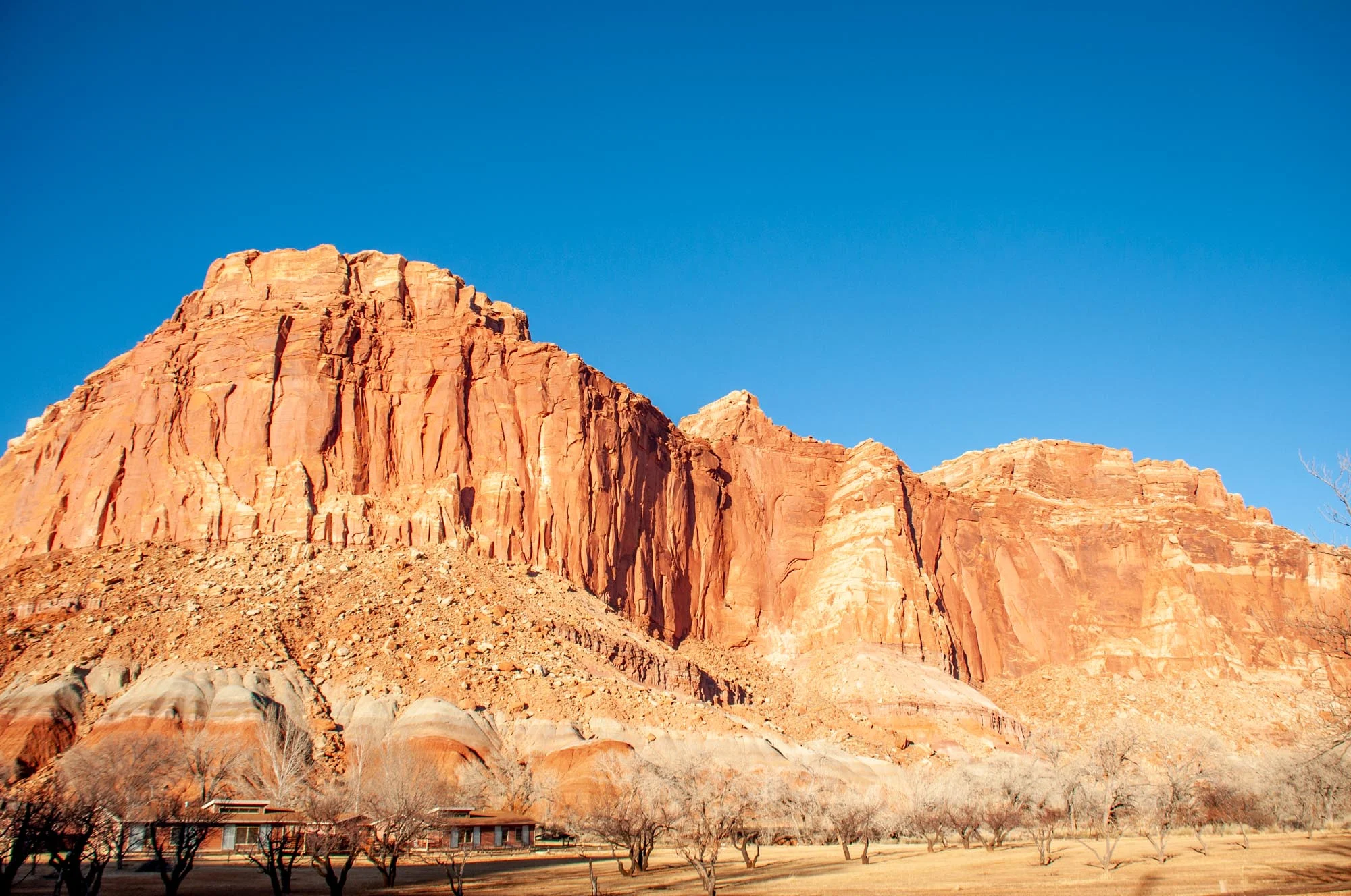
When it comes to the national parks of Utah, Capitol Reef is frequently overlooked. It is actually the 2nd largest park in Utah by size, but dead last in the number of visitors. And they don’t know what they’re missing.
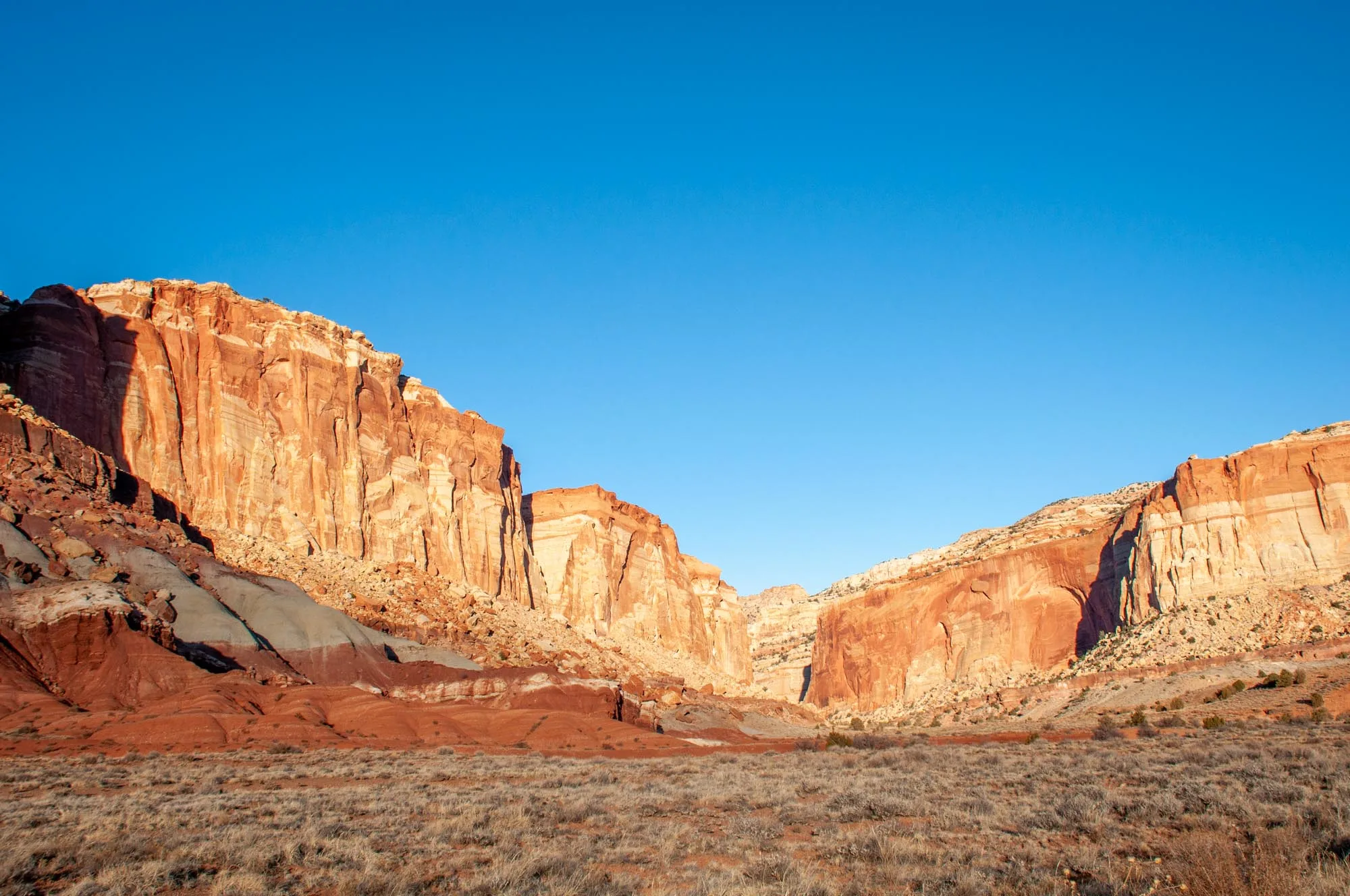
The red rock formations that dominate the park are located within the Waterpocket Fold. This 100-mile-long wrinkle in the Earth’s crust lifted the western zone over 7,000 feet above the areas to the east. The resulting rock formations are nothing less than stunning.
Highlights: The undisputed highlight of Capitol Reef is the massive red rock edifice that stretches for miles. However, on closer look, you’ll realize the rock is not one solid stone wall but is instead broken down into sections. Each of these has their own name, like The Fluted Wall, The Castle, Navajo Dome and The Ferns Nipple.
Many visitors find the incredibly narrow (and beautiful) Capitol Gorge to a highlight of the park. This drive takes you through one of the slot canyons that make Utah famous. This slot canyon just happens to be wide enough you can drive through!
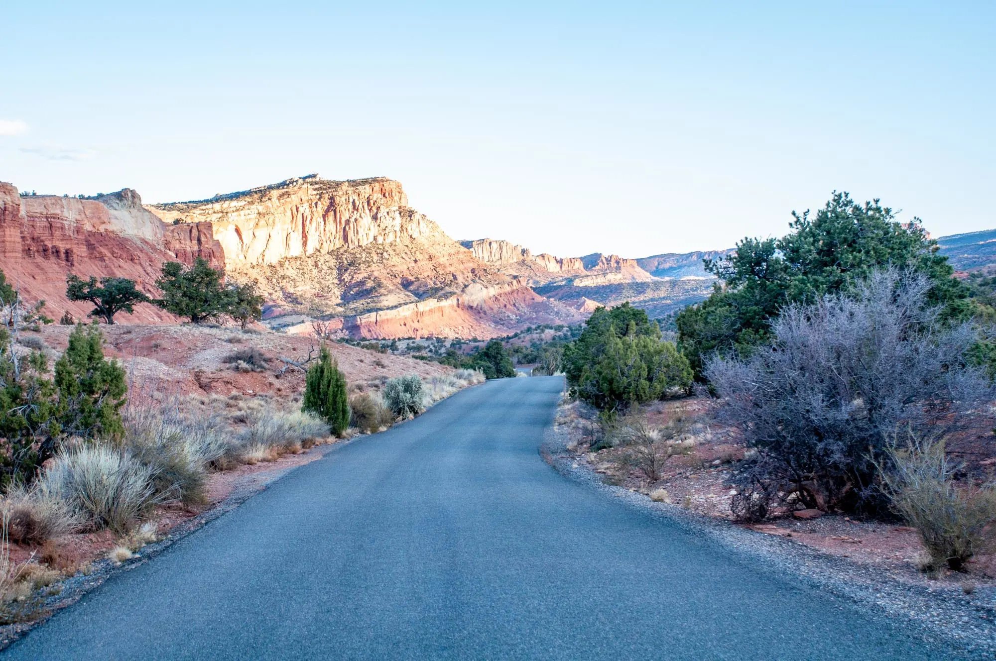
Getting there: Capitol Reef is located due south of Salt Lake City and in the middle of the state. It is 2 ½ to 3 hours northeast of Bryce Canyon (time depends on the number of stops you make for pictures). To get from Bryce to Capitol Reef, follow Scenic Byway 12. This is one of the most beautiful drives in the country and follows the Hogback north. Don’t rush this trip!
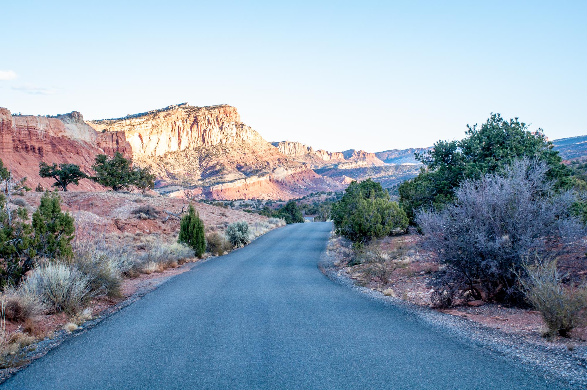
Within Capitol Reef park, the main road is called Scenic Drive. This 8.0 mile road runs north-to-south and isn’t an loop, so you’ll need to return back the same way. From the southern end of the Scenic Drive, the Capitol Gorge road will branch off to the east (it doesn’t have an outlet so you’ll have to return through the gorge).
Tips: The red rock monolith faces due west, which means that it is entirely in shadow all morning. Try to time your visit for the afternoon or evening. The rocks reflect the light spectacularly at sunset! Having all-wheel drive or a SUV is helpful for the Capitol Gorge road (you don’t need a fancy high-clearance Jeep).

Stay/Eat: The Capitol Reef Resort is located just west of the park and offers a range of accommodation options, from traditional motel to glamping tents. We found it to be quiet and very comfortable. In the town of Torrey, the Days Inn Torrey Capitol Reef offers basic and predictable lodging at a reasonable price.
For breakfast, lunch or great coffee, head to The Wild Rabbit in Torrey. They’ve got great burritos. For dinner, check out the Rim Rock Patio between Torrey and the park. They’ve got great pub fare, including nachos and excellent pizzas.
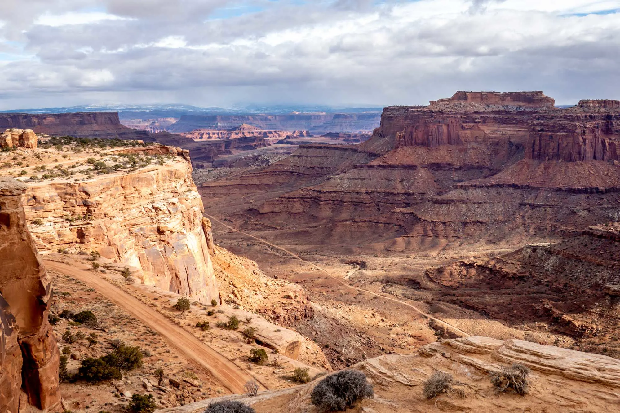
Canyonlands National Park

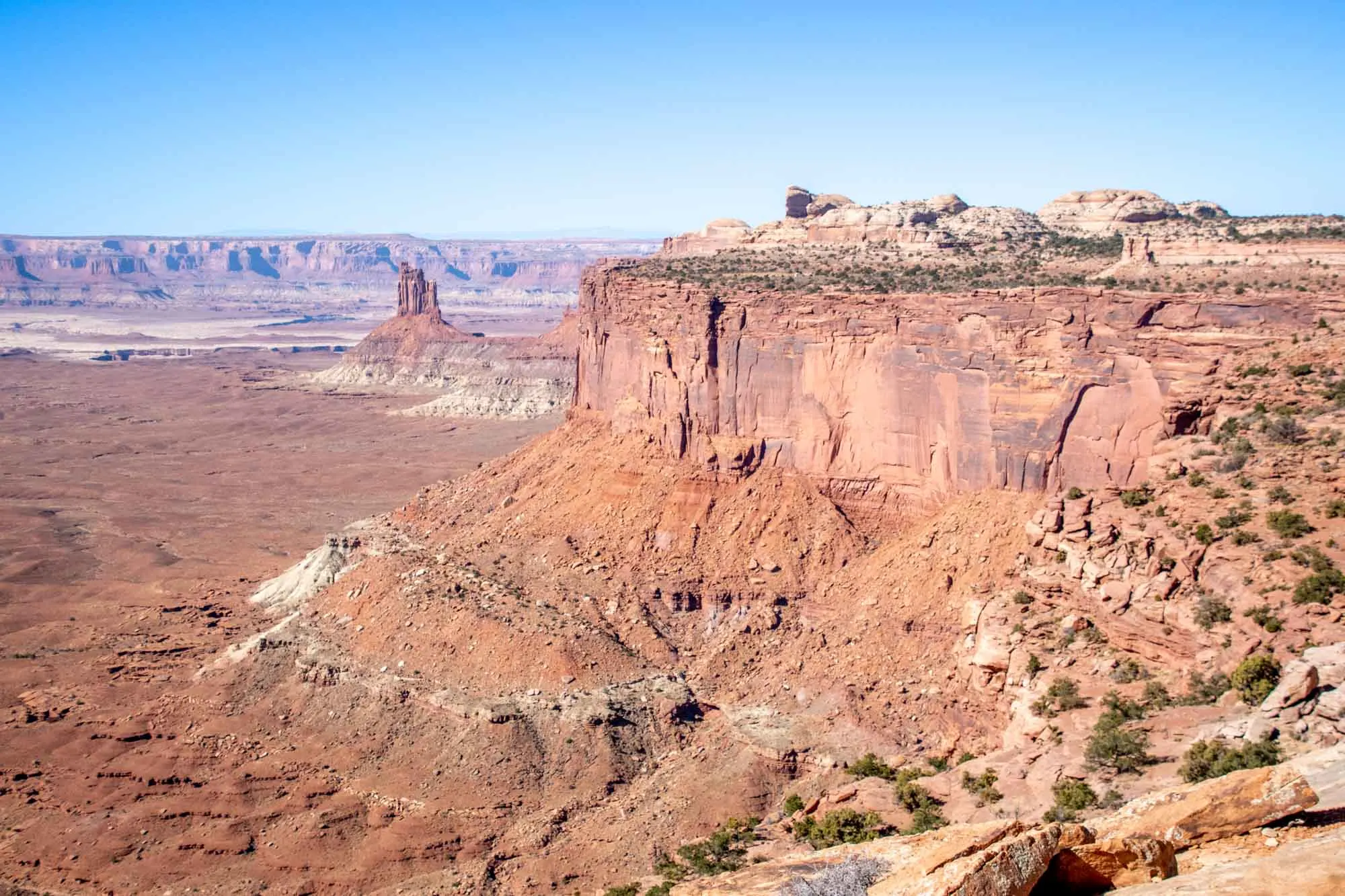
The Canyonlands is one of the largest national parks in the U.S. and the largest in Utah. It is divided into three distinct districts known as Island in the Sky, The Needles, and The Maze.
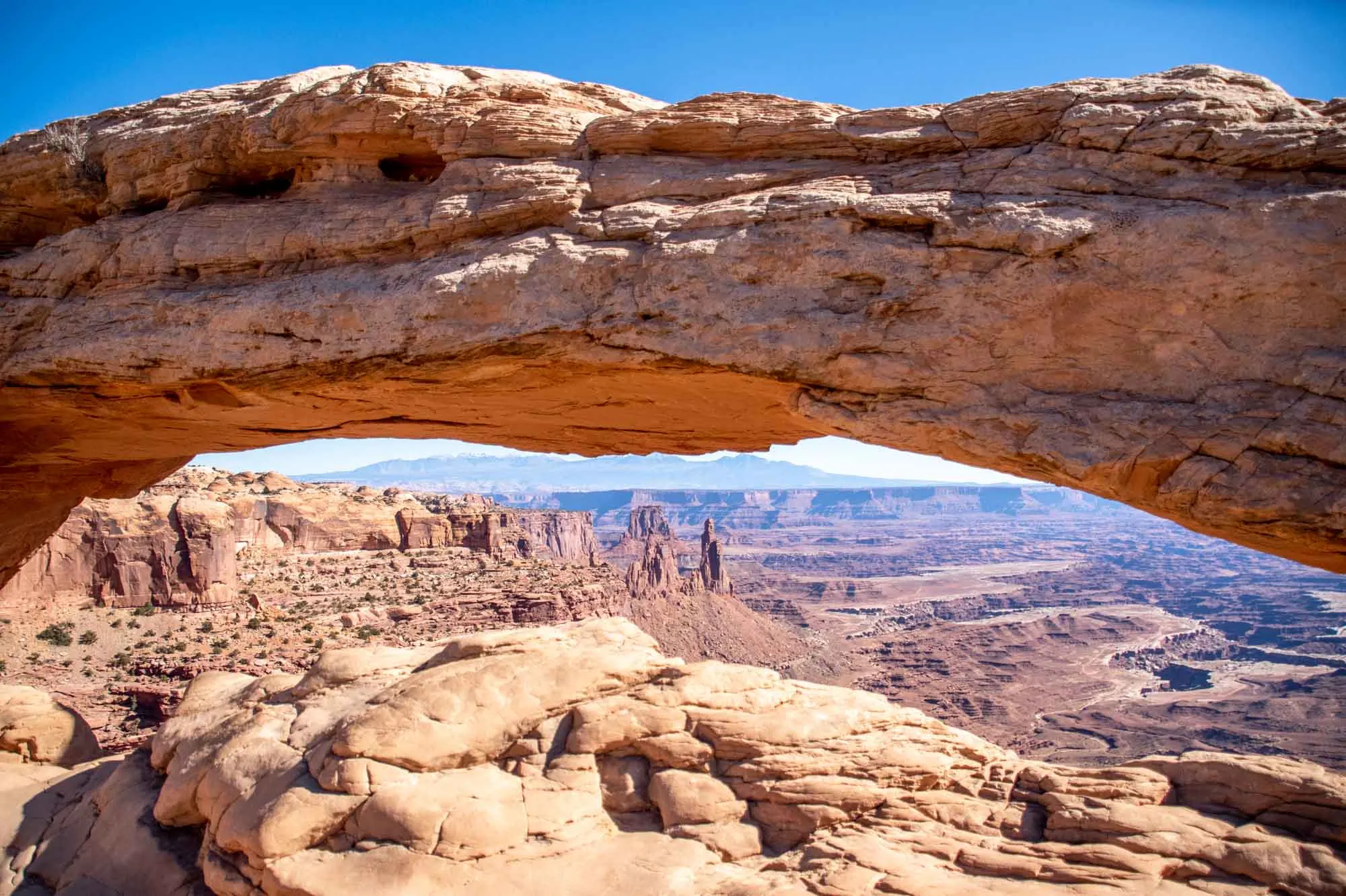
Most visitors will go to Island in the Sky. From the top of this plateau, you have commanding views of the Colorado River valley, and both the Needles and Maze districts in the distance. This area is the closest to Moab and Arches, and is nearly all paved and very accessible.
Located south of Moab, The Needles is more rugged and authentic. Located 40 minutes off the major road, you need to want to come here. And yet, it is still fairly accessible both on foot and to 4×4 vehicles.
Finally, The Maze is remote and difficult. This section of the part is located to the west of the Colorado River. There are no paved road to the Maze or within it. But for those who seek the thrill of adventure can find it here – one of the most remote places in America.
Highlights: In the Island in the Sky, focus on the stunning views from Grand View Point Overlook. The Mesa Arch is a short ½ mile hike with an incredible arch that is very popular at sunrise (the sun comes up and is visible through the arch). For those with a high clearance 4×4 driving the Shafter Trail is thrilling (and not for those who are scared of heights).
In the Needles, Confluence Overlook gives a glimpse of where the mighty Colorado River meets the Green River. This spot is the reason for the park’s existence. Also don’t miss Chesler Park and the Druid Arch.
Finally, in the Maze, the Fins are like no other place on earth. More symmetrical and orderly than Bryce Canyon, these rock ridges stretch into the distance.

Getting there: The Canyonlands are located due east of Capitol Reef National Park, although the roads do not go there. You need to go up to I-70 and then head east with the entire drive taking about 2 ½ hours. Canyonlands are about 4 hours south and east of Salt Lake City.
The town of Moab serves the entire region. Island in the Sky is about about 40 minutes from Moab. Within the Island in the Sky district, there is no shuttle service and ample parking (except at Mesa Arch). The Needles district is 90 minutes southwest of Moab. If you are exploring the Maze, consider using Green River as a base instead of Moab.
Tips: Unless you are planning a longer Utah national park trip, focus your time on one district, rather than driving back and forth between them. Also, it is possible to visit Island in the Sky in the morning and then head into Arches NP in the later afternoon (allowing you to spend more time in Arches!).

Stay/Eat: The city of Moab makes a great base to stay when visiting both Canyonlands and Arches. Springhill Suites by Marriott is the closest hotel to Canyonlands. Otherwise, the Hotel Element, Hyatt Place Moab and the Hampton Inn Moab also make a great base.
Antica Forma serves an amazing pizza and is definitely recommended. Sweet Cravings serves excellent breakfast and lunch sandwiches. For fine dining, the Sunset Grill and Il Posto Rosso are the nicest restaurants in town.
The local grocery store is City Market, which makes a great spot to pick up food and take a picnic into the park for lunch. There isn’t a restaurant in Canyonlands National Park.
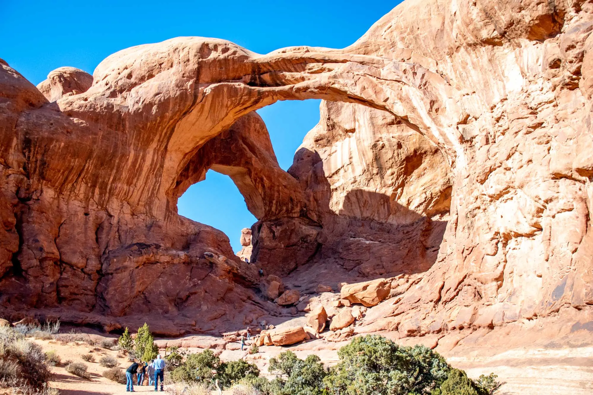
Arches National Park
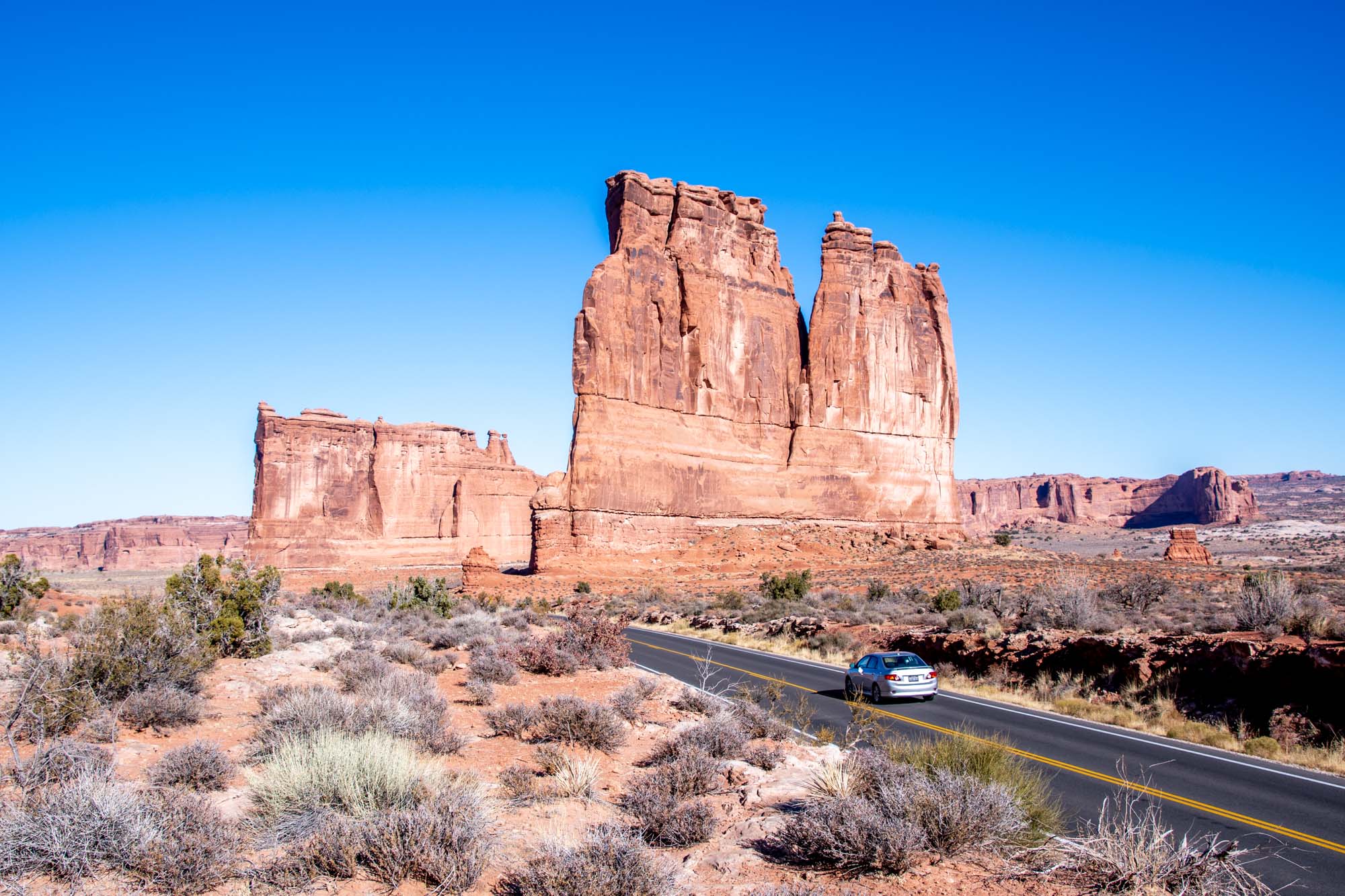

When it comes the best national parks in Utah, there’s Arches and then there’s everything else. And while Arches may be last on our list, it is certainly not least!
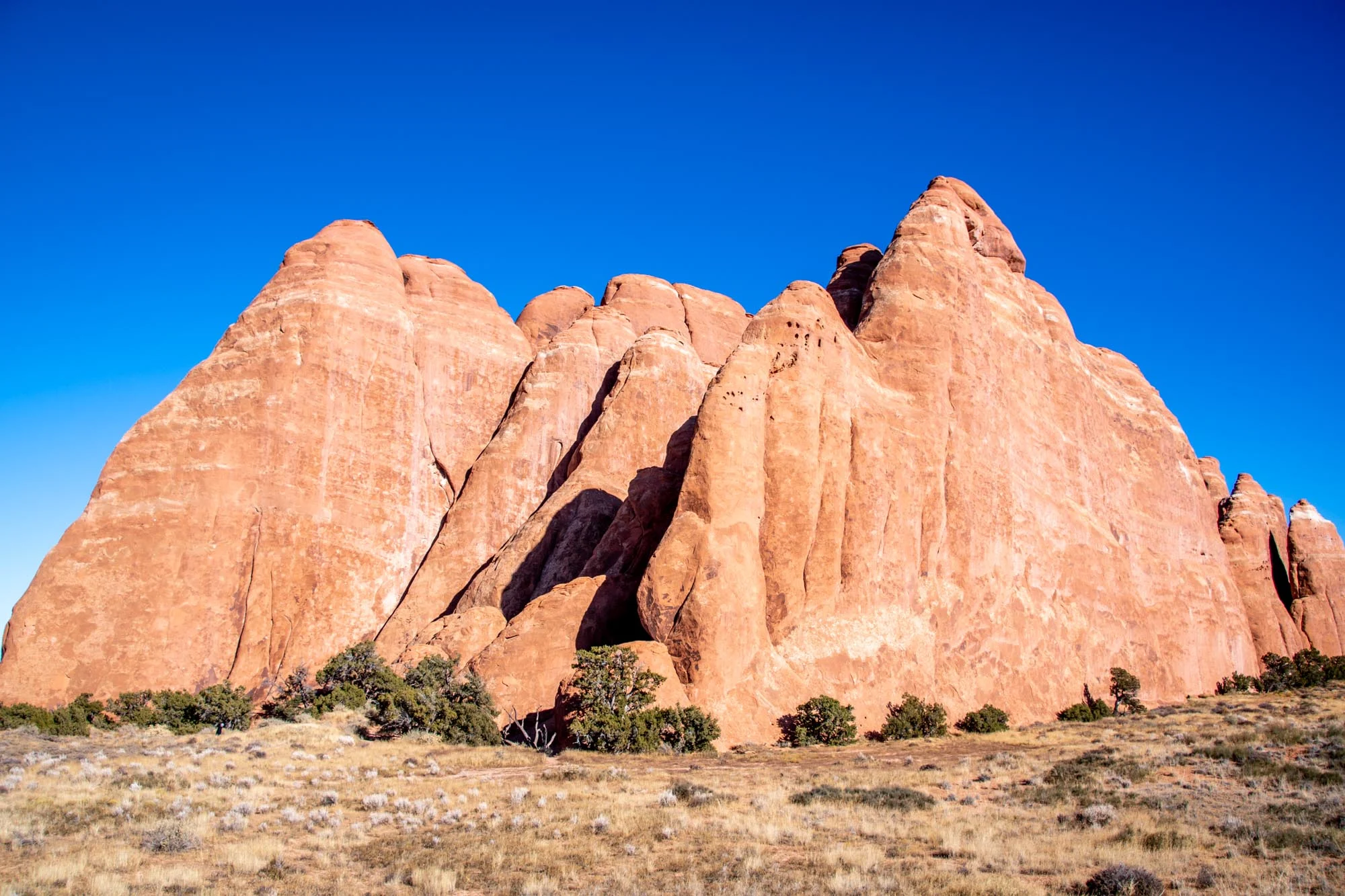
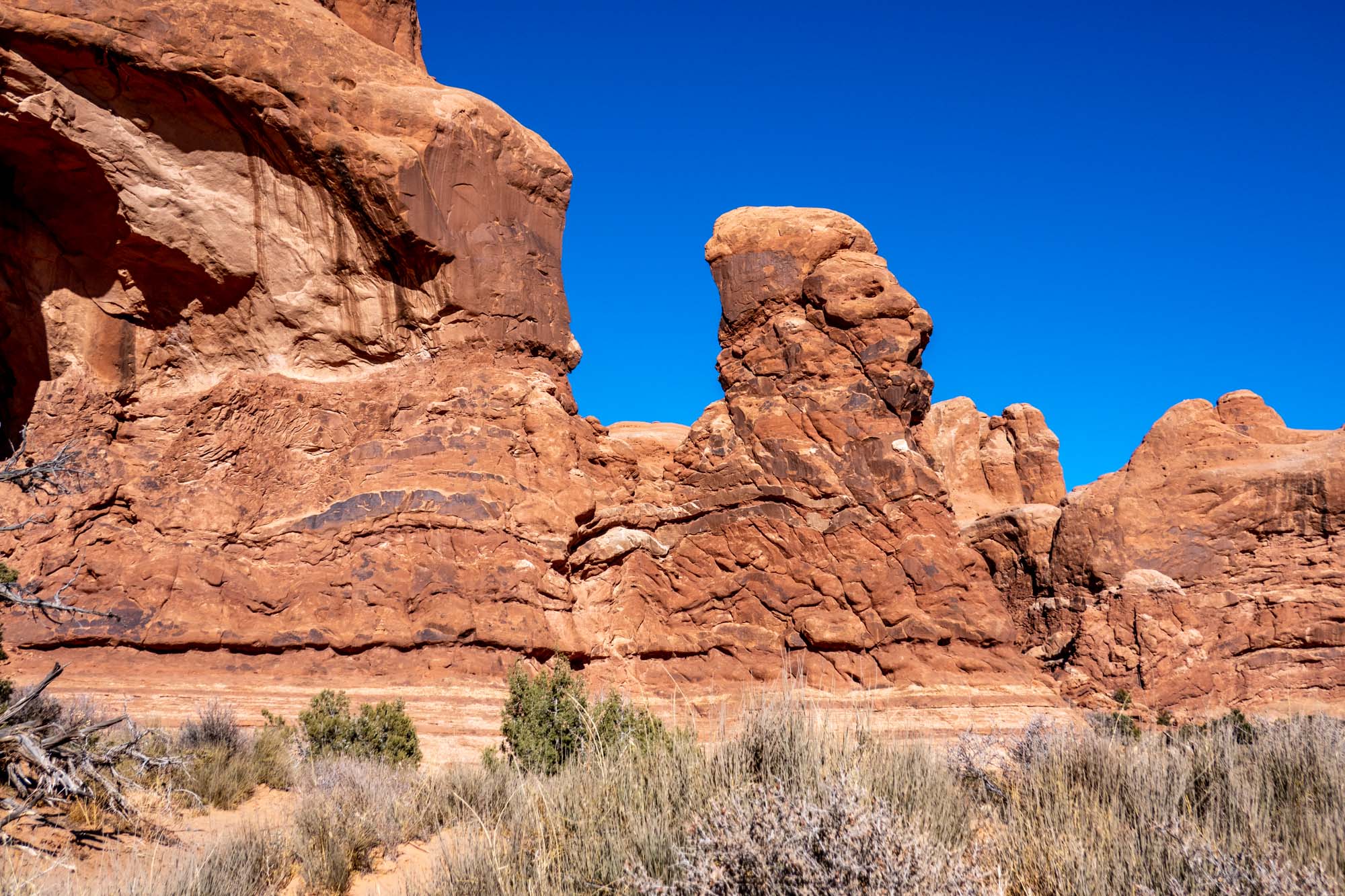
Hands down, Arches is the best national park in Utah. It has everything: stunning rock walls, sandy backcountry trails, petrified dunes, cool rock formations and those famous sandstone arches that have made the state famous.
Visiting Arches requires some planning. From April 3-October 3, Arches is on a mandatory timed reservation system from 6am to 5pm. Reservations for the month are released three months in advance on this website. For example, the April reservations are released on the first business day in January. An additional reservation fee is also charged on top of the park entrance fee. If you don’t score a spot in the advance system, there are a very small number of tickets available the night before. And if you strike out there, you are still OK as long as you are in the park by 6am (but other people will be doing the same thing, so be early!).

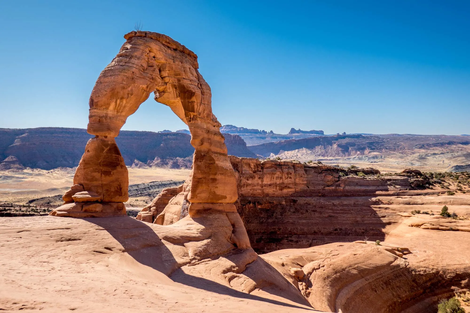
Highlights: Far and away the highlight of Arches National Park is the famed Delicate Arch. This stunning arch pops up from a slab of sandstone and offers a glimpse of the snow-capped peaks in the distance. This 3-mile hike is difficult (allow about 1 ½ hours up and 40 minutes back down), but well worth it.
The Park Avenue trail is 1 mile in length and follows the canyon floor between two stunning red rock walls. Nearby, the Courthouse Towers provide an imposing view.
Balanced Rock is an interesting and unique formation that is popular with photographers – both day and night. The Windows section of the park (North and South Windows, Double Arch, and Garden of Eden) have a dense collection of rock formations that are very popular and easy to reach.
Finally, the remote Devils Garden is at the far end of the park and offers incredible opportunities for hiking…and many more aches to discover. In total, there are over 2000 arches and rock formations inside the park.
Be sure to check out our detailed guide: The Best Things to Do in Arches National Park.
Getting there: Arches National Park is 10 minutes north of downtown Moab and 30 minutes northeast of the Canyonlands Island in the Sky. Use Moab as your base to explore the park (there’s also a ton of other things to do in the Moab area).
Within the park itself, there is no shuttle bus, so you’ll either need to drive yourself or ride a bike. Cycling is a popular activity in the park and large sections are relatively flat.
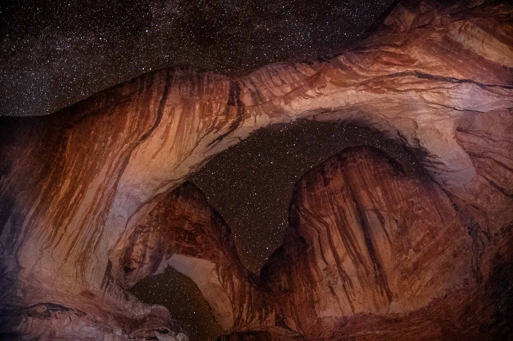
Tips: You can never have enough time in Arches! Consider visiting some of the major sites (Balanced Rock, Courthouse Towers, Double Arch) several different times during the day as the sun moves through the sky. Also, Arches is a certified International Dark Sky park, so consider driving up at night and check out the stars or do some astrophotography.
On each of our last three trips to Arches, I’ve driven up around 10:00pm for star photography. It makes for some magical moments in a magical place. Balanced Rock, Panorama Point and Garden of Eden are popular stargazing spots.

Stay/Eat: The city of Moab makes a great base to stay when visiting Arches and Canyonlands. Springhill Suites by Marriott is the closest hotel to Arches. Otherwise, the Hotel Element, Hyatt Place Moab and the Hampton Inn Moab also make a great base.
After a day hiking in the park, load up on pizza from Antica Forma or Italian from Pasta Jay’s. You can get breakfast burritos or lunch sandwiches at Sweet Cravings.
There isn’t a restaurant in Arches National Park, so grab supplies at the City Market grocery store for a picnic in the park.
Itinerary

A Utah National Parks road trip is a popular way of seeing all of these majestic places. Most people visit The Mighty 5 as a roundtrip out of either Salt Lake City or Las Vegas. However, before booking your flight, check on whether it is possible to fly into either Las Vegas or Salt Lake City and then fly out of the other (essentially a one-way trip). Sometimes you can find good deals that make this an attractive option.
Finally, if you want to add a little more time, it is possible to fly into and out of Denver, but that would add more time, but would give you a chance to see the famous Rocky Mountain National Park and visit the hot springs in Colorado.
Here is our suggested Mighty 5 itinerary:
- Zion: Minimum of 1 full day in the park. If you are a big hiker, you might add a second day.
- Option: Add an extra day and do a small detour to Kanab to visit either The Wave or White Pocket.
- Bryce Canyon: Spend 1 afternoon and then return to spend the morning.
- Capitol Reef: 1 afternoon/sunset (unless you want to do a lot of hiking)
- Canyonlands: 1 full day
- Arches: 2 full days
For those who don’t want to drive, there are several Utah national park tours available from both Las Vegas and Salt Lake City which include all of the parks:
- 5 day tour from Las Vegas
- 8 day Mighty 5 tour from Salt Lake City
- 7 day national parks tour from Salt Lake City (which includes some other hidden gems)

What to Bring
National Parks Pass: Some of these parks are expensive and multiple days in the parks can really add up. We STRONGLY encourage everyone to get an annual National Parks Pass (called America the Beautiful). You can purchase it at your first park, or you can pre-purchase online or in most REI stores.
Camera: Capture these stunning parks, arches and canyons on treasure the memories. Be sure to bring your camera!
Maps: Have both a road map of Utah as well as detailing hiking maps for any hikes you want to do. Do not rely on your phone’s GPS! Cell reception in most of the parks and in many places in southern Utah is bad or non-existent.
Water Bottle: Most of Utah is a desert, and a high-elevation desert at that. You should be drinking about a gallon of water per person per day. Even in winter or on cloudy days, you will dehydrate fast. Drink lots of water.
Food: Plan ahead. You’ll find restaurants and food markets in the major towns, however, these will close earlier in the evening than you are accustomed to. Most of the parks have minimal facilities in them. Plan ahead to take food or snacks with you.
Sunscreen: The sun in Utah can be brutally unforgiving. Make sure you bring lots of sunscreen and reapply frequently. This applies even in the winter!
Lance Longwell is a travel writer and photographer who has published Travel Addicts since 2008, making it one of the oldest travel blogs. He is a life-long traveler, having visited all 50 of the United States by the time he graduated high school. Lance has continued his adventures by visiting 70 countries on 5 continents – all in search of the world’s perfect sausage. He’s a passionate foodie and enjoys hot springs and cultural oddities. When he’s not traveling (or writing about travel), you’ll find him photographing his hometown of Philadelphia.